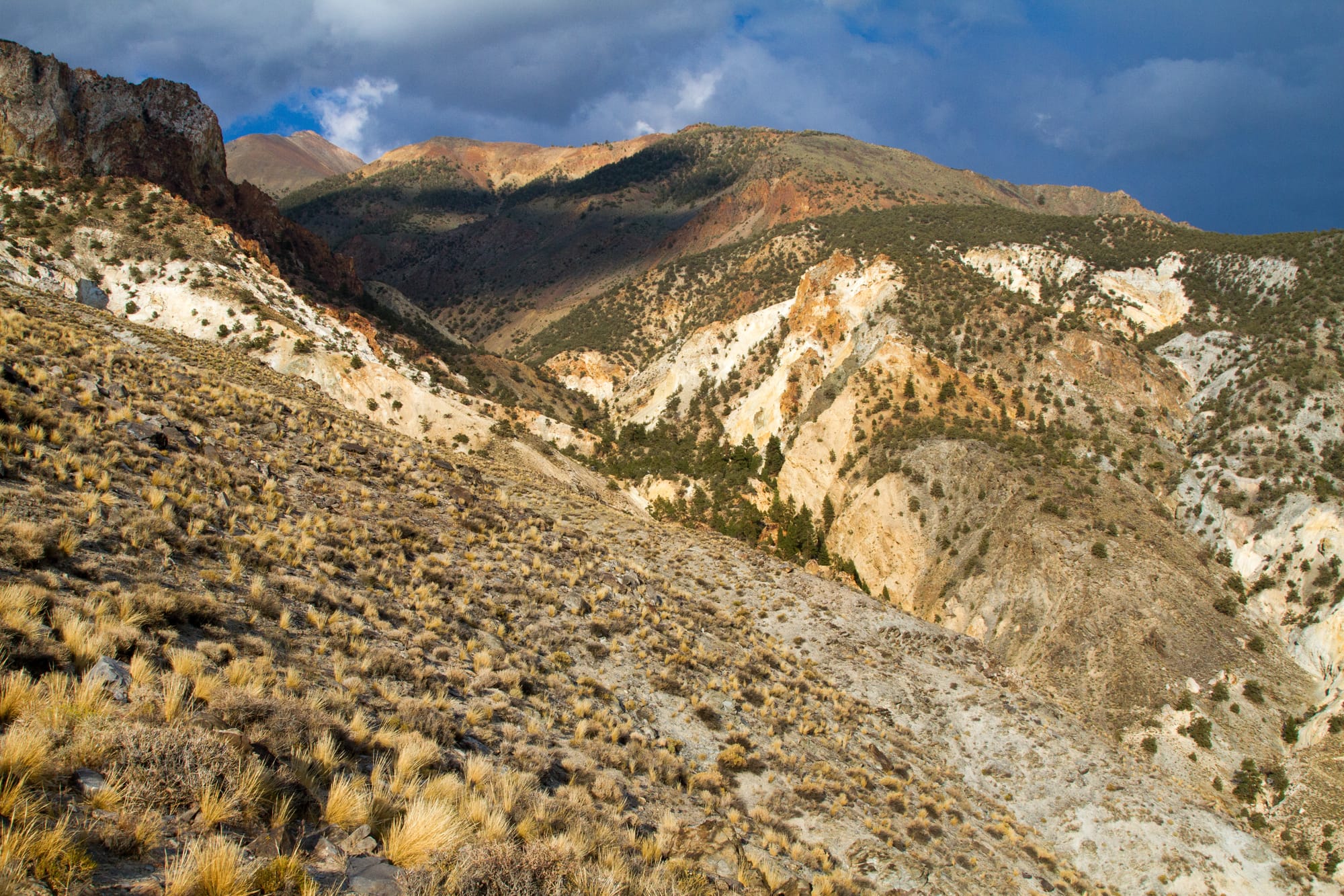
The Champion Spark Plug Mine is quite a place. High on the western flank of the White Mountains, at around 9,000 feet, miners spent a quarter century extracting a rare mineral called andalusite and hauling every pound of it down to the valley on the backs of mules. There was no road to the mine and there never would be. Everything went up and down a steep mule trail: ore, food, tools, building materials, a 600-pound air compressor, even the disassembled pieces of a commercial cooking range and walk-in refrigerator.
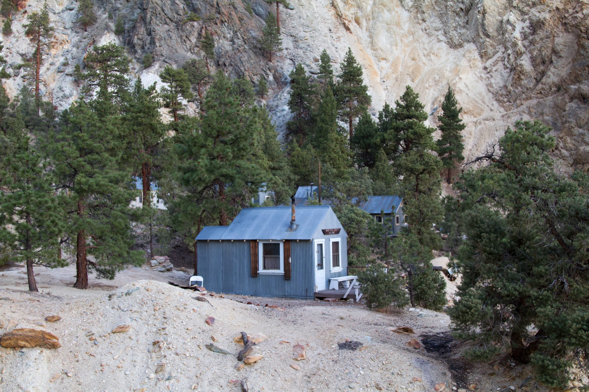
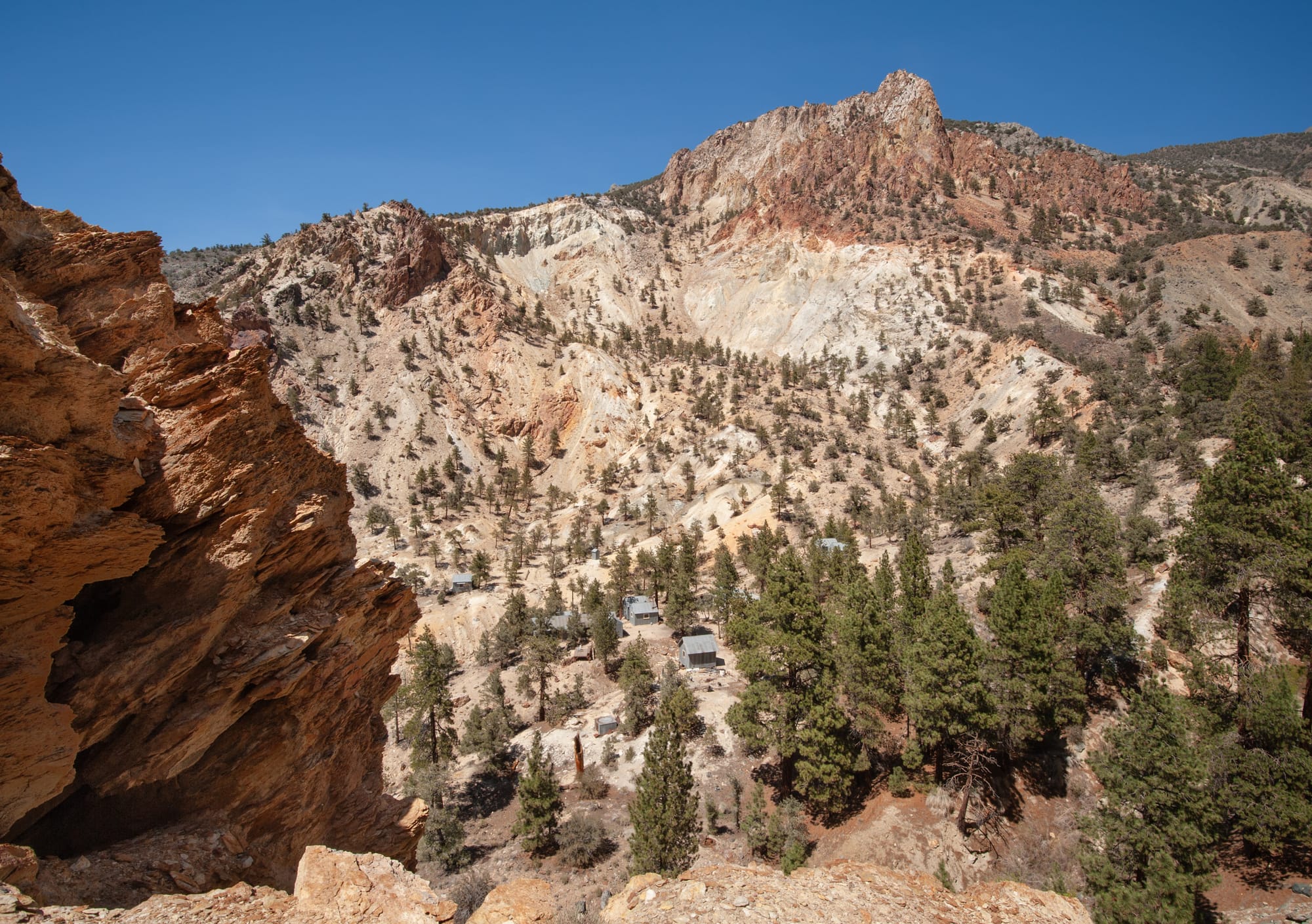
Two camps supported the operation. The lower one, Black Eagle Camp, sits at about 7,250 feet in a grove of Jeffrey pine. The Upper Camp, another 1,500 feet higher, clings to the cliffs just below the mine tunnels.
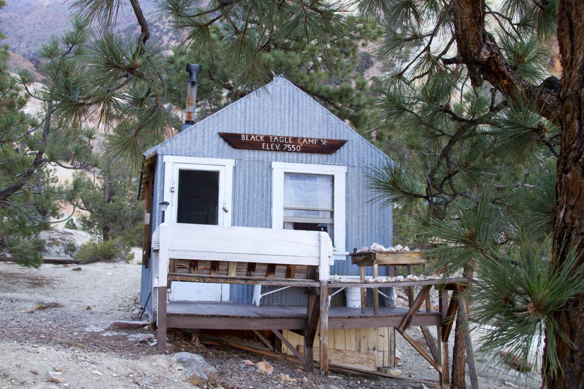
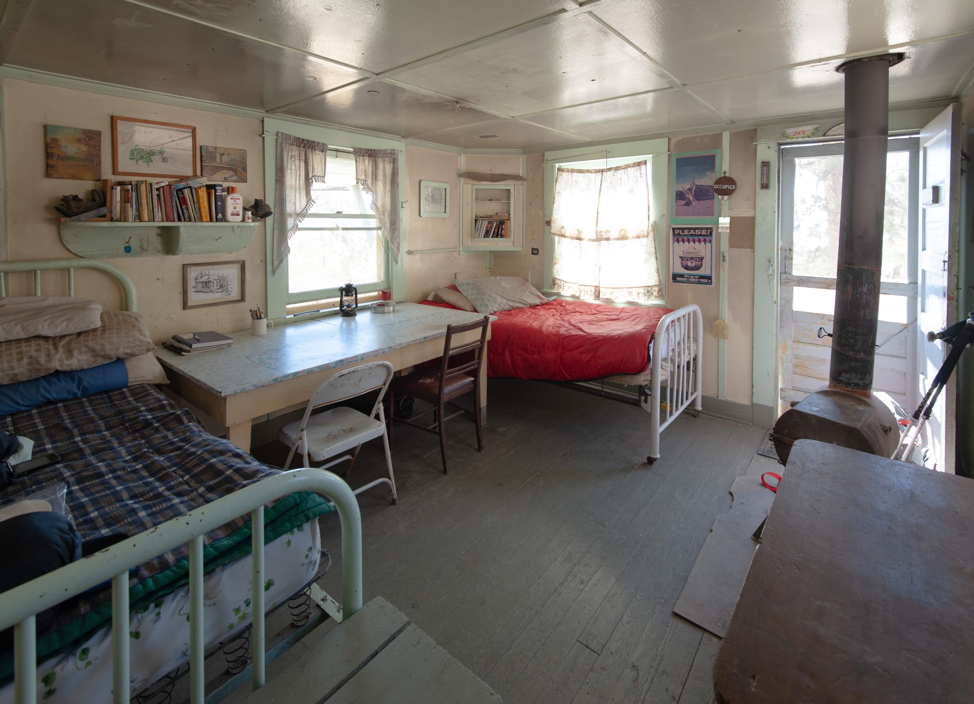
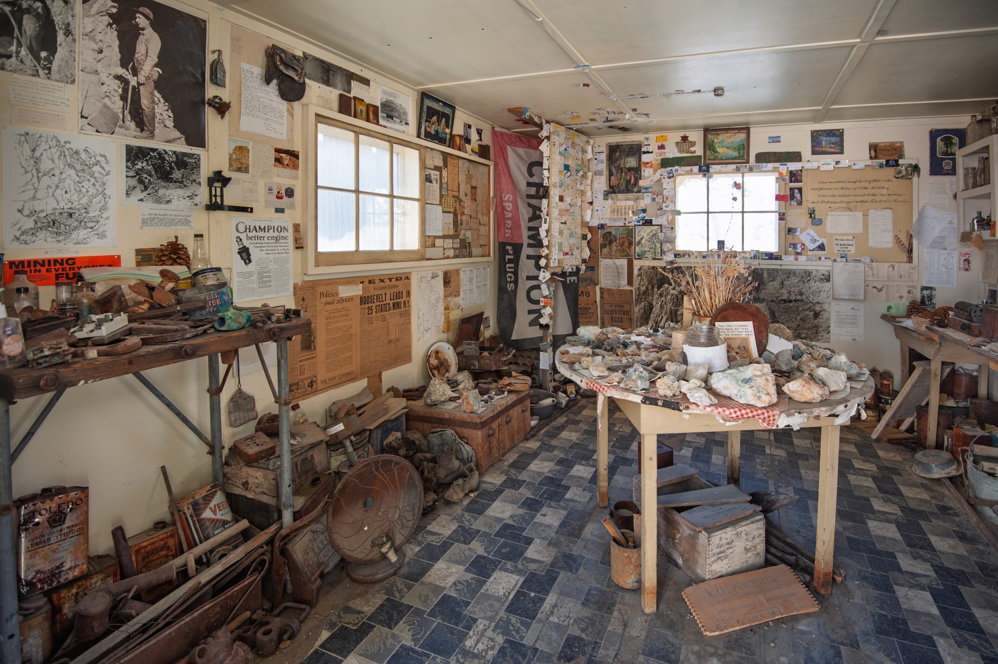
Today, Black Eagle Camp survives as a small oasis in the mountains, with half a dozen furnished cabins, a cookhouse, outhouses, a workshop, and even a museum full of artifacts from the mine. Volunteers maintain the cabins, which are on a first-come, first-served basis and free to use. If you come up here, follow Backcountry Cabin Etiquette and help care for this incredible place.
History
The story of the Champion Spark Plug Mine begins with a dentist who couldn't stop thinking about ceramics. Dr. Joseph Arthur Jeffery graduated from the University of California in 1895 with a doctorate in dental surgery, then spent three years as an instructor in chemistry and metallurgy. He practiced dentistry in San Francisco, but his real interest was in porcelain. By 1905, he and his brother Benjamin were experimenting with spark plugs, and they soon organized the Jeffery-Dewitt Insulator Company to manufacture them.
The spark plugs of that era used ordinary porcelain insulators, which cracked under heat and vibration. Jeffery knew that sillimanite, a rare aluminum silicate mineral, could be fired into a ceramic far harder and more heat-resistant than anything then available. After World War I, the government was fully behind improving engine reliability for the growing Air Corps, and a better spark plug insulator was a practical priority. The problem was that no commercial deposit of natural sillimanite had ever been found in the United States. Manufacturing it synthetically was possible but extremely expensive.
Jeffery was convinced a natural deposit existed. His studies suggested that the right conditions of extreme pressure and temperature, the kind that accompany volcanic disturbances, might be found in the White Mountains of eastern California. In 1917, he came across a brief article by geologist Adolph Knopf in an obscure journal, noting the presence of sillimanite crystals in the Inyo Range. Jeffery spent part of 1918 exploring, found the locality Knopf had described, but was disappointed by the quantity and quality of what he found.
He returned in 1919. The story of his discovery, as told by Bill and Louise Kelsey in The Album and repeated in Champion's own obituary for Jeffery, has become part of Owens Valley lore. Jeffery and a prospector worked their way up a narrow canyon on the western slope of White Mountain, sleeping on rough, rocky ground.
One restless, moonlit night, Jeffery kept tossing unusually heavy stones out from under his bedroll. By dawn, he recognized them for what they were: dense fragments of sillimanite, debris that had fallen from somewhere above. Systematic prospecting traced the source to a massive, light-colored cliff hundreds of feet high, with a perpendicular face that could only be reached from above. The prospector dangled from a rope to collect specimens, which confirmed that the cliff contained an enormous deposit. "Hey, Doc!" he reportedly yelled. "We've found it this time!"
L: Coming into camp. R: The camp.
What Jeffery had found was andalusite, a close chemical relative of sillimanite. The deposit sat in a zone about 300 feet wide and 500 feet long, in fault-sheared metamorphic rock within the White Mountain fault zone. The mineral occurred as loose, intergrown prismatic crystals surrounded by quartz and schist, along with a suite of associated minerals including rutile, lazulite, topaz, fluorite, and the rare phosphate mineral woodhouseite, named for Jeffery's own son-in-law.
Jeffery bought the Milner Ranch at the base of the mountain, renaming it the Jeffery Ranch. It would serve as his base of operations, providing meat and produce for the miners and forage for the pack mules. Two canyons drained onto the ranch: Milner Canyon (often called "Water Canyon") and what became known as Jeffrey Mine Canyon.
He put his son-in-law, Charles Douglas Woodhouse, in charge of developing the mine. Woodhouse was a mineralogist and an educated, capable manager. One of his first challenges was designing and building the mule trail from the ranch to the mine site, since the canyon was too steep and narrow for a road. The trail climbed the canyon's north shoulder, exposed to high desert sun and wind, then eased into the gorge itself with a series of tight switchbacks gaining over 3,000 feet of elevation.
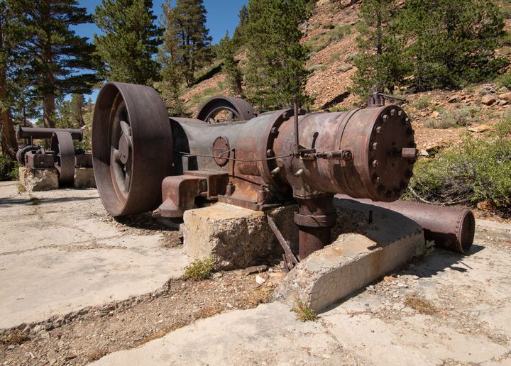
The lower camp at about 7,250 feet, called Black Eagle, included a cookhouse, bunkhouses, a wash house, a machine shop, and a blacksmith shop. The cookhouse had a commercial-size cooking range and a walk-in refrigerator, both of which had to be dismantled and packed up the trail in pieces. The biggest challenge was a 600-pound air compressor. The stoutest mule in the string, "Ole Maude," carried it up the mountain, carefully putting one hoof in front of the other. At the mine, a hoist lifted the load from her back. She lay down in the dirt and sighed.
Late in 1928, Dr. Jeffery hired George W. Clarkson, a tall, white-haired former Southern Sierra Power Company man and World War I veteran, to develop the hydroelectric system and manage the ranch. Clarkson built a power plant using a Pelton wheel in Milner Canyon, fed by water through a stone-lined aqueduct (which is still there). The power and telephone lines then had to be packed up the mountain. Mules were trained to carry poles around the switchbacks, two mules tied together with two poles on their backs, a process that took careful training and ingenious rigging to keep the animals from pushing each other off the trail.
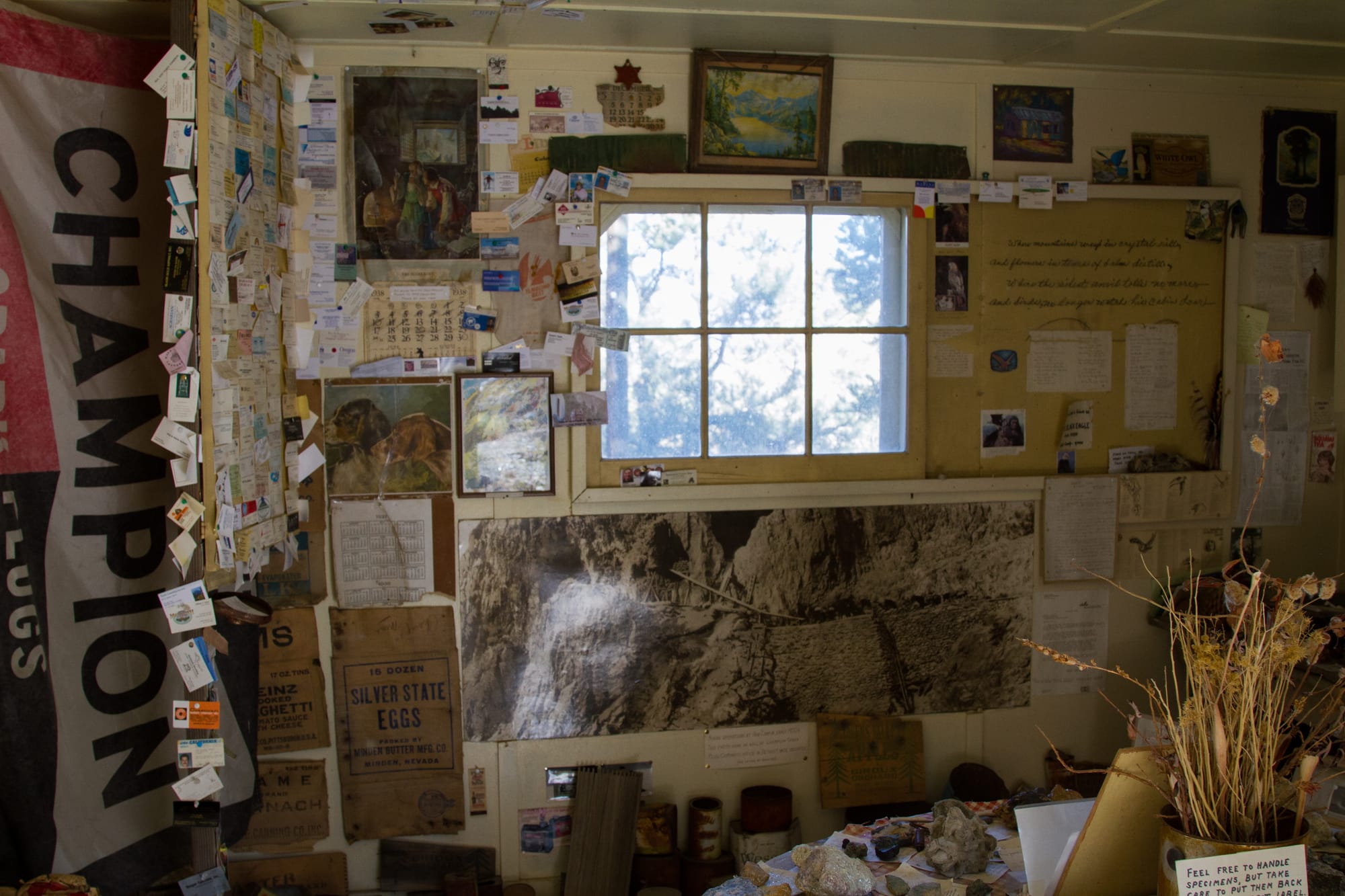
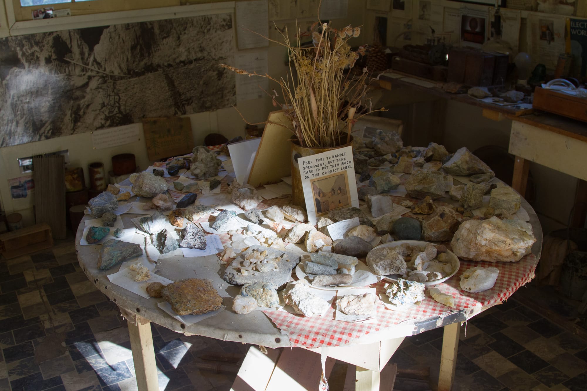
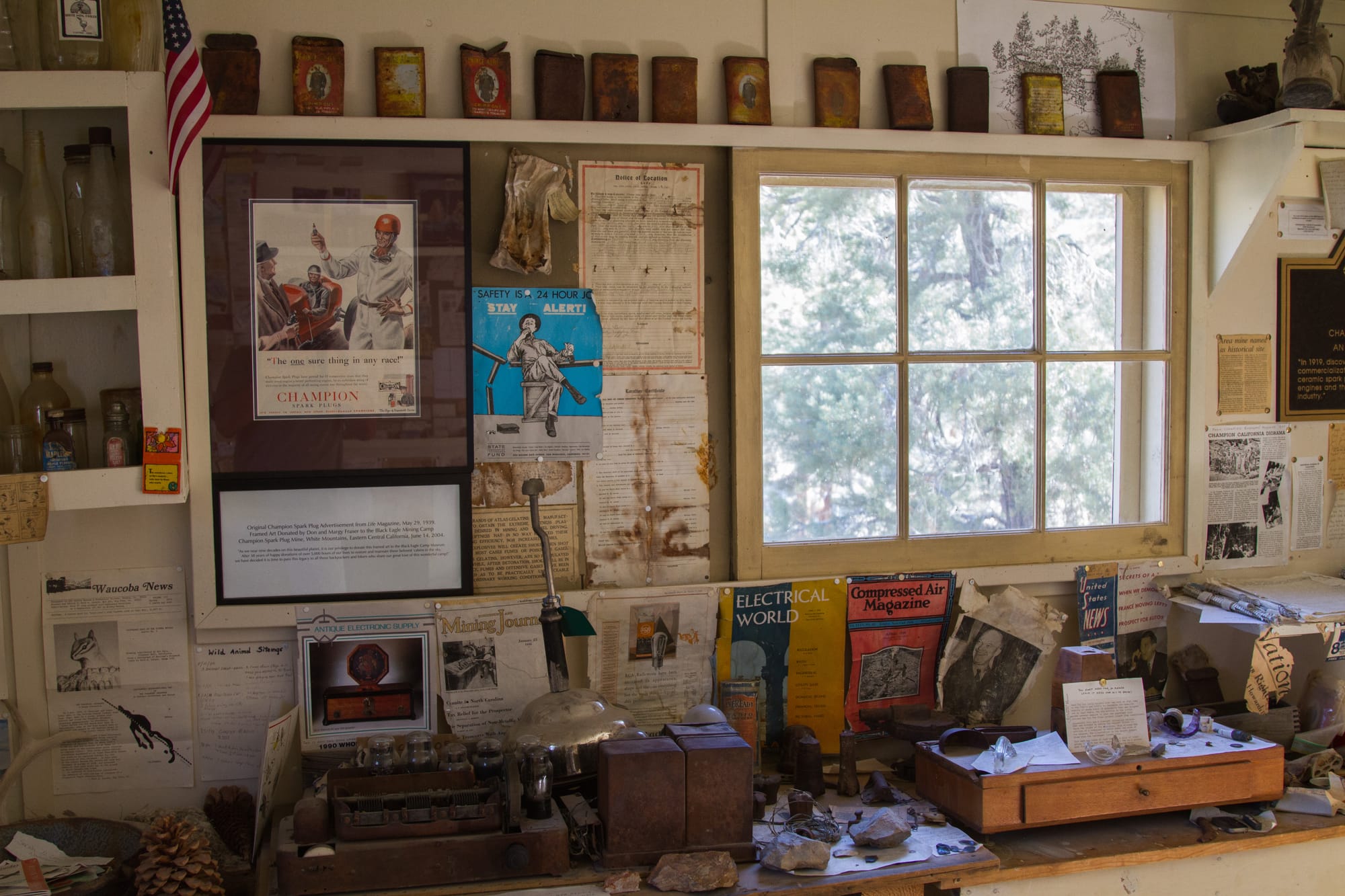
In the museum
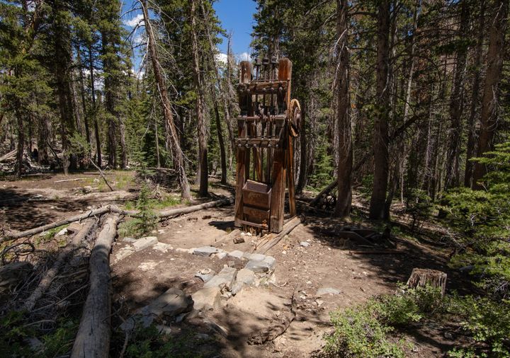
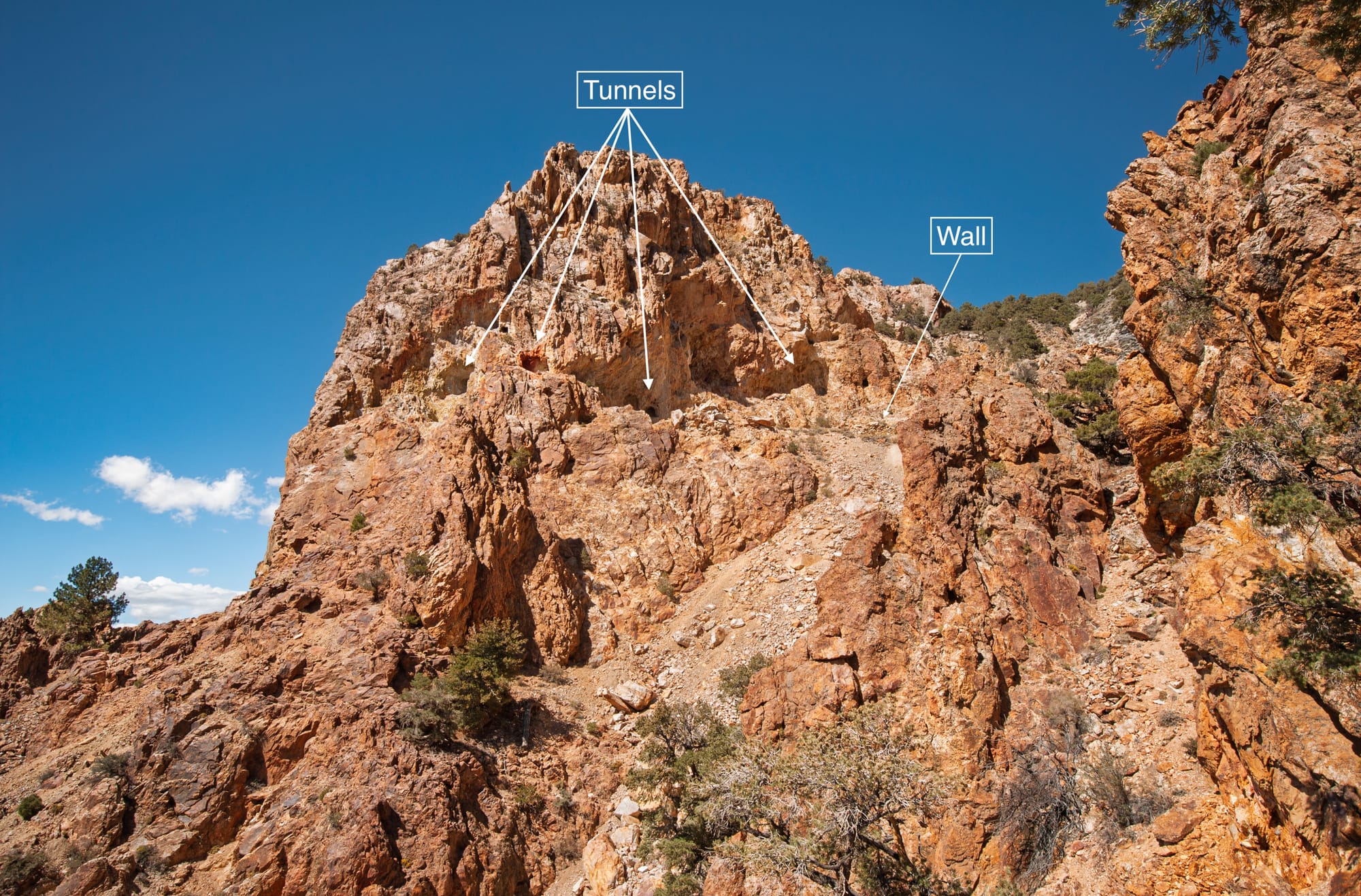
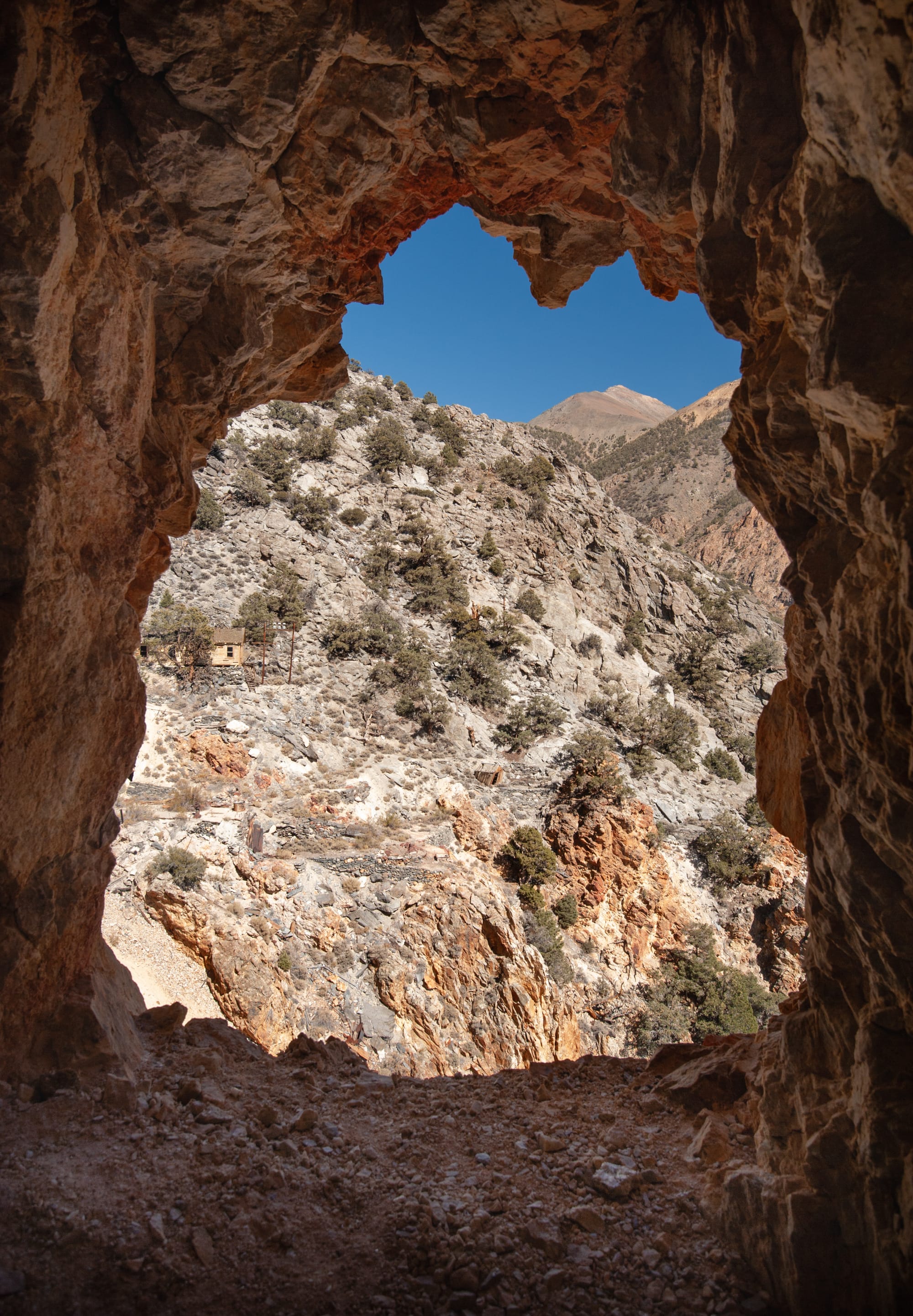
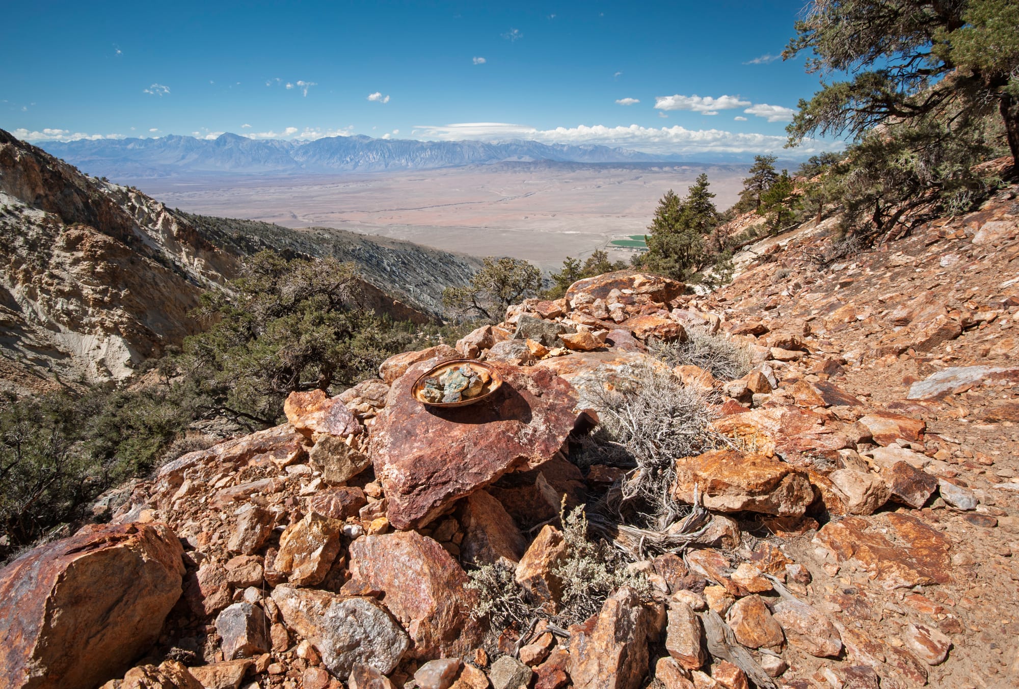
The mine workings sat at elevations between 8,600 and 10,000 feet. Mining was by open stope and pillar method, with tunnels used for exploration and haulage. The largest adit ran 500 feet, with stopes up to 100 feet long, 50 feet wide, and 75 feet high. Miners pushed ore cars out of the mountain, and the ore was hand-sorted on site, with bits of quartz and pyrite broken off and discarded.
Packing the ore out required a specific piece of gear called an aparejo, a large leather "envelope" stuffed with hay until it was about six inches thick, large enough to cover a mule's back for heavy loads. A willow frame kept its shape, and a leather strap served as a cinch, with a wide britchen passing under the mule's tail to keep the load from shifting forward. Two sacks of ore, about 95 to 100 pounds each, were loaded on each side, giving each mule a total load of roughly 400 pounds. The operation ran 16 mules and two packers, making two trips a day with two strings of eight mules, winter and summer.
The ore's journey from mountainside to factory floor required nine separate handlings: blasted or barred off the cliff face, hammered and broken up, hand-sorted, sacked into 95-pound bags, loaded onto mules, carried down the trail and dumped into ore bins at the road's end, trucked three and a half miles to Shealy Siding on the Southern Pacific's narrow gauge line, transferred to narrow gauge rail cars for transport to the standard gauge connection, and finally shipped to Champion's plant in Detroit. There, White Mountain andalusite became the hard, fine porcelain that went into spark plug insulators and laboratory crucibles.
Among the packers who worked the trail, Len Leidy held the first packing contract, then was followed by Wendel Gill. The last packers were the father-and-son team of Spray and Ernie Kinney. Ernie later channeled his mountain experiences into landscape paintings.
Between 1921 and 1945, the mine produced 26,457 tons of andalusite valued at $183,992. The principal production years were 1922 to 1936, when about 20,000 tons of 53-percent andalusite were extracted. In its early years, the Champion Mine was the only commercial source of andalusite known in the world.
In 1921, the Jeffery-Dewitt Company merged with Champion Spark Plug Company, and the mine continued under Champion's ownership. Dr. Jeffery served as vice president of Champion and president of Champion Sillimanite Inc., the California subsidiary. He held 23 patents related to spark plug manufacturing. He remained active in the business and the ranch until his death in Detroit on December 28, 1944, at the age of 71.
Photos courtesy Hugh Smith
The mine shut down soon after in 1945, when a practical synthetic material called mullite replaced the andalusite porcelain used in spark plugs. The patented claims reverted to public domain in 1982.
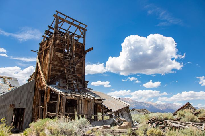
The Upper Camp originally had four small cabins, all lost to a careless fire in 1987. Only quick action by firefighters airlifted to the scene saved the one remaining structure from destruction.
Down at Black Eagle, the camp has fared much better, thanks to Don and Margey Fraser and a dedicated group of Owens Valley volunteers who adopted the site. Margey started the museum in 1971. Visitors are welcome to stay in any unoccupied cabin. Remember to pack it in and pack it out.
Directions
Getting There
From the intersection of Hwy 395 and Hwy 6 in Bishop, drive 19.0 miles north on Hwy 6. Reset your odometer here. Turn right (east) onto White Mountain Ranch Road, which follows the southern edge of White Mountain Ranch. Continue 0.7 miles on this road, then turn left (north) onto a dirt road. Follow this for 0.3 miles to dirt Jeffrey Mine Road, which heads northeast (right turn) toward the mountains. This road climbs the alluvial fan, then enters Jeffrey Mine Canyon about 2.5 miles from Hwy 6. High clearance and 4WD will be required beyond this point. In one mile (3.5 miles from Hwy 6), you will come to a road which cuts back sharply to the left; this road leads to the Upper Trail (see Map below).
While this road could possibly be driven, which would reduce your hike by about 1.3 miles and eliminate 990 feet of elevation gain, it is not recommended. The road is a narrow and extremely steep shelf road, with few places to turn around if you can't continue. Furthermore, it is deeply rutted, with severe off-camber sections. Only very experienced off-road drivers, with highly capable vehicles, should even consider attempting it. If you do elect to drive this route, you would follow this road 1.4 miles, through a few tight switchbacks to where it turns sharply north. There is a parking spot here at a wide spot in the road. The Upper Trail continues due east up the canyon toward the Black Eagle Mine Camp. The trail is signed; it joins up with the Lower Trail 0.6 miles farther up the canyon.
The much safer approach is to stay on the lower road an additional 0.3 miles past the Upper Road junction, to the Lower Trailhead at the end of the road. While this last stretch of road requires careful driving, it is significantly safer than the upper road.
The Hike
Lower Trail to Black Eagle Mine Camp
Hike: Moderate, 2.9 miles out and back, 1,270 ft gain round trip. 2 to 3
hours
The hike follows the old mule trail up the south side of the canyon. The trail is generally well-defined and in good shape, with a few small washouts, but is very steep in places. The Upper Trail comes in from the north at 1.1 miles. The only water available is at the Black Eagle Camp, although the water system may be dry. You should carry enough water to reach the camp and return to your vehicle, as a precaution.
Upper Trail to Black Eagle Mine Camp
Hike: Moderately Strenuous, 4.7 miles out and back, 1,560 ft gain
round trip. 3 to 4 hours
The first 1.4 miles of this route follows the Upper Road, to where the road turns sharply north (see Map below). Look for the signed trail, which continues east up the canyon, at that bend. The trail climbs moderately at first, following the north wall of the canyon, then drops down slightly to join up with the Lower Trail coming in from the south. At this point, you will be 0.4 miles from the Black Eagle Camp.
Black Eagle Camp to Upper Mine
Hike: Moderate, 4.0 miles out and back, 1,400 ft gain round trip. 3 to 4
hours
The trail starts at the northeast corner of the camp; look for the metal trail sign
nailed to a tree. The trail is a little spotty at first, but soon becomes well-defined,
climbing east up the canyon. The trail becomes vague in a few places as you
approach the Upper Mine. The last 1/4 mile is rough, as the trail has mostly
disappeared on a very steep scree slope. Don't forget to take plenty of water! You can see the mine tunnels in the red cliffs above from here; just find the best way to the top of the scree slope, and you will soon arrive at the Upper Camp.
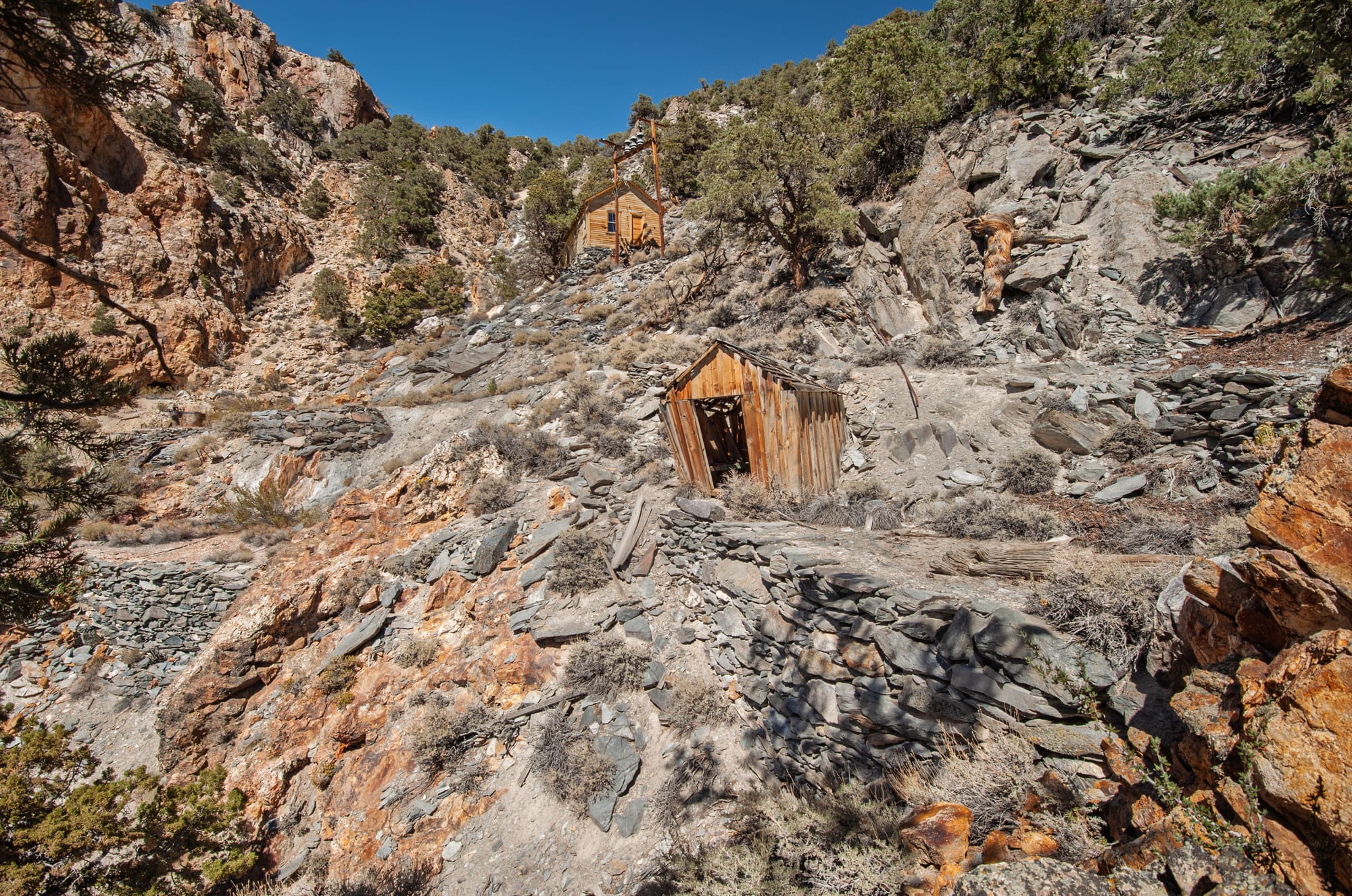
There were originally four small cabins here, which were carelessly burned down
in 1987 by visitors. Two structures remain: a small, dilapidated wood shed, and a
more substantial building overlooking the camp. Numerous rock walls and a few
concrete pads lie just below the mine tunnels, which honeycomb the red cliffs
above.
Map
KML
GPS Waypoints
- Lower Champion Spark Plug Trailhead: 37.61626°, -118.33764°
- Black Eagle Camp: 37.61797°, -118.31985°
- Upper Mine: 37.62303°, -118.31296°
Guy's Photos (2010)
Hugh's photos (2014)
Champion Spark Plug Hilton
Black Eagle Mining Camp Museum
Cookhouse at the Champion Spark Plug Mine
Wash House