Just northwest of Mono Lake lies Lundy Canyon, home to a Mono County campground, a large lake, and a small resort with a few cabins and campsites. Most visitors today come for the fishing, hiking, and fall color, probably unaware that this quiet area was once home to a booming mining district in the late 1800s. The once-bustling town of Lundy, at the head of Lundy Lake, served numerous mines in Lundy Canyon and adjacent Lake Canyon. Today only a few original buildings from the town remain, now part of Lundy Resort or private summer residences.
The district's crown jewel was the May Lundy Mine, which extracted $3 million in gold and silver before closing. Located in Lake Canyon, a spectacular hanging valley that branches south from Lundy Canyon near the lake's inlet, the mine sits within one of the Eastern Sierra's overlooked treasures. While fire, avalanches, and scavenging have removed much of the original equipment and structures, what remains still gives a tantalizing glimpse into the monumental enterprise which once occupied this now peaceful valley.
History
Gold was discovered in Mill Canyon (subsequently re-named Lundy Canyon) in 1879, leading to the formation of the Homer Mining District. Prospectors fanned out into the surrounding area, soon finding rich ore high on the eastern wall of Mt. Scowden in Lake Canyon. Claims were filed, and the May Lundy Mine began operations in 1880. The ore was transported via horses and mules to a 5-stamp mill just west of Lundy. A toll road from Lundy to the mine opened the following year; today that road is still used as the hiking trail. The operation expanded: a boarding house, lodging house, blacksmith shop, and store house were built near the mine's three tunnels, at almost 11,000 feet. By 1882 the operation was booming: a tram was built from the mine to the floor of Lake Canyon, and the population of Lundy peaked at 500 residents. The good times were not to last, however; the mine closed down in 1884, sitting idle for the next two years.
The mine briefly re-opened in 1887-88, operated by lessees. The tram had been destroyed by an avalanche; the ore was transported by mule to a small 2-stamp mill in Lake Canyon. The operation significantly expanded after the Jackson and Lakeview Mining Company acquired the mine in 1891. The tram was re-built, and a large 10-stamp mill was constructed at the base of the tram. A wooden dam was constructed on Lake Oneida, just above the mill, to provide electrical power.
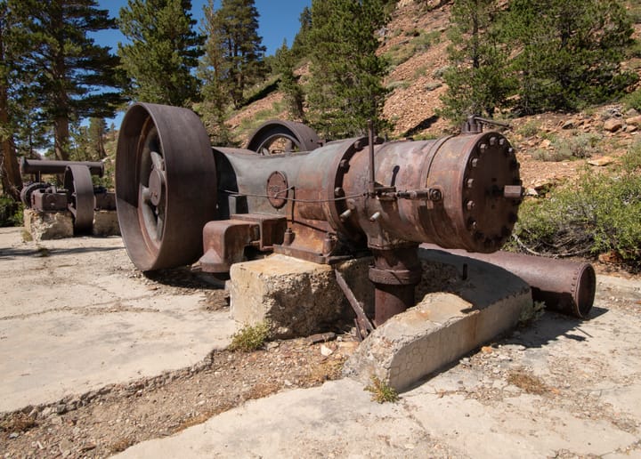
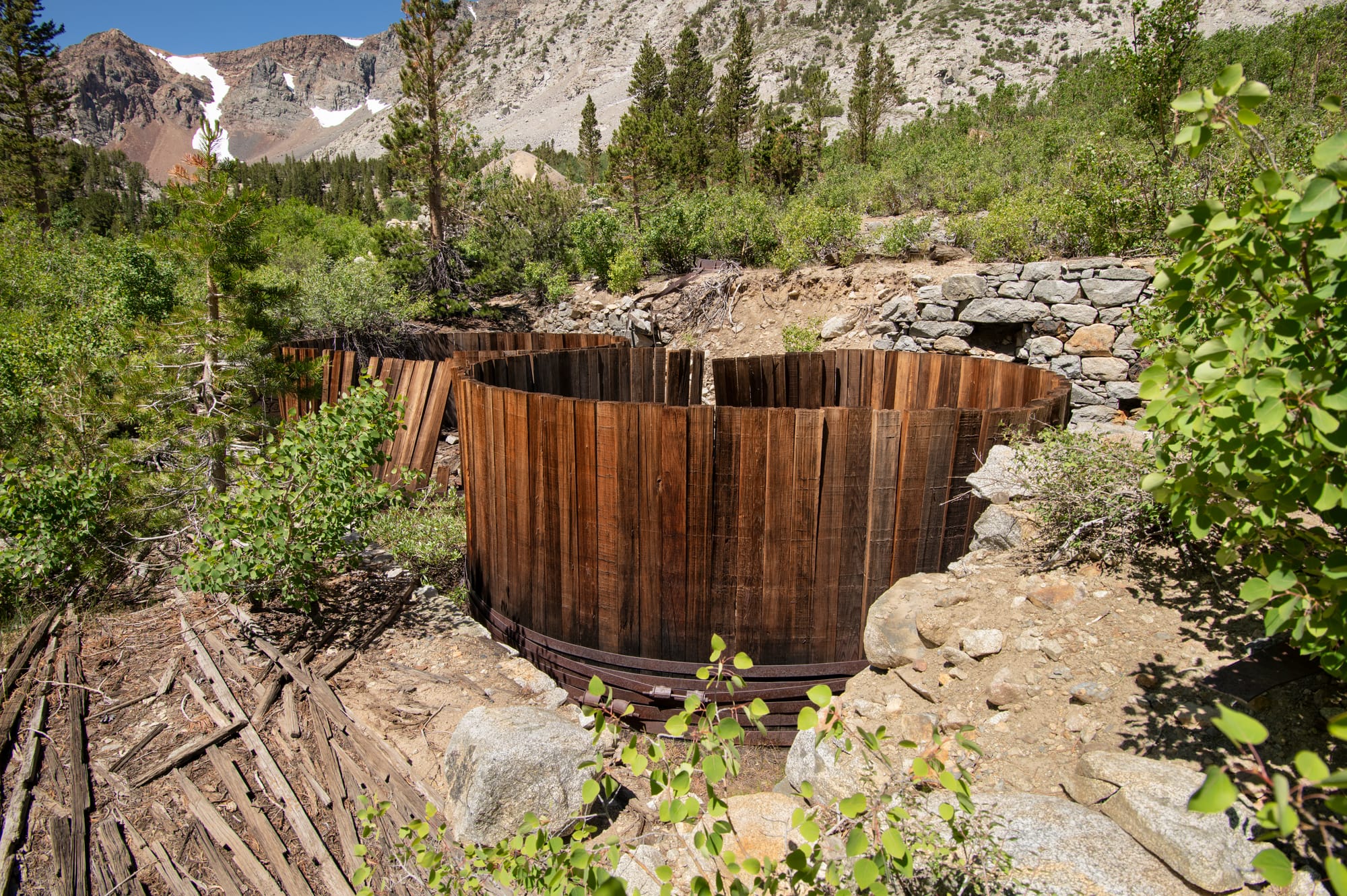
The mine was sold again in 1900, this time to the Crystal Lake Mining Company. The new owners expanded the mill to 20 stamps, and built a powerhouse on Mill Creek near Lundy to provide electrical power. The mill included an Allen crusher, Dorr Thickener, storage tanks, a Dorr Classifier, an Allis-Chalmers ball mill, 6-cell Kraut flotation machines, a Kraut cleaner cell, and an Amico filter. The company also began drilling an adit near the mill, intending to intersect the May Lundy vein directly below the tunnels high above. Although they never connected to the upper workings, the adit eventually reached 3/4 of a mile into the mountain; the huge mine dump is visible from miles away. In addition, in 1908 they built a large cyanide mill with two wooden vats, below the existing 20-stamp mill. (This is according to a Forest Service information sign near the mine; one other reference source claims the cyanide mill was built in 1894. It is uncertain which is correct.) Avalanches in 1911 destroyed the Lundy powerhouse as well as several buildings at the mine. Subsequently, the mine never fully resumed operations, closing in 1914.
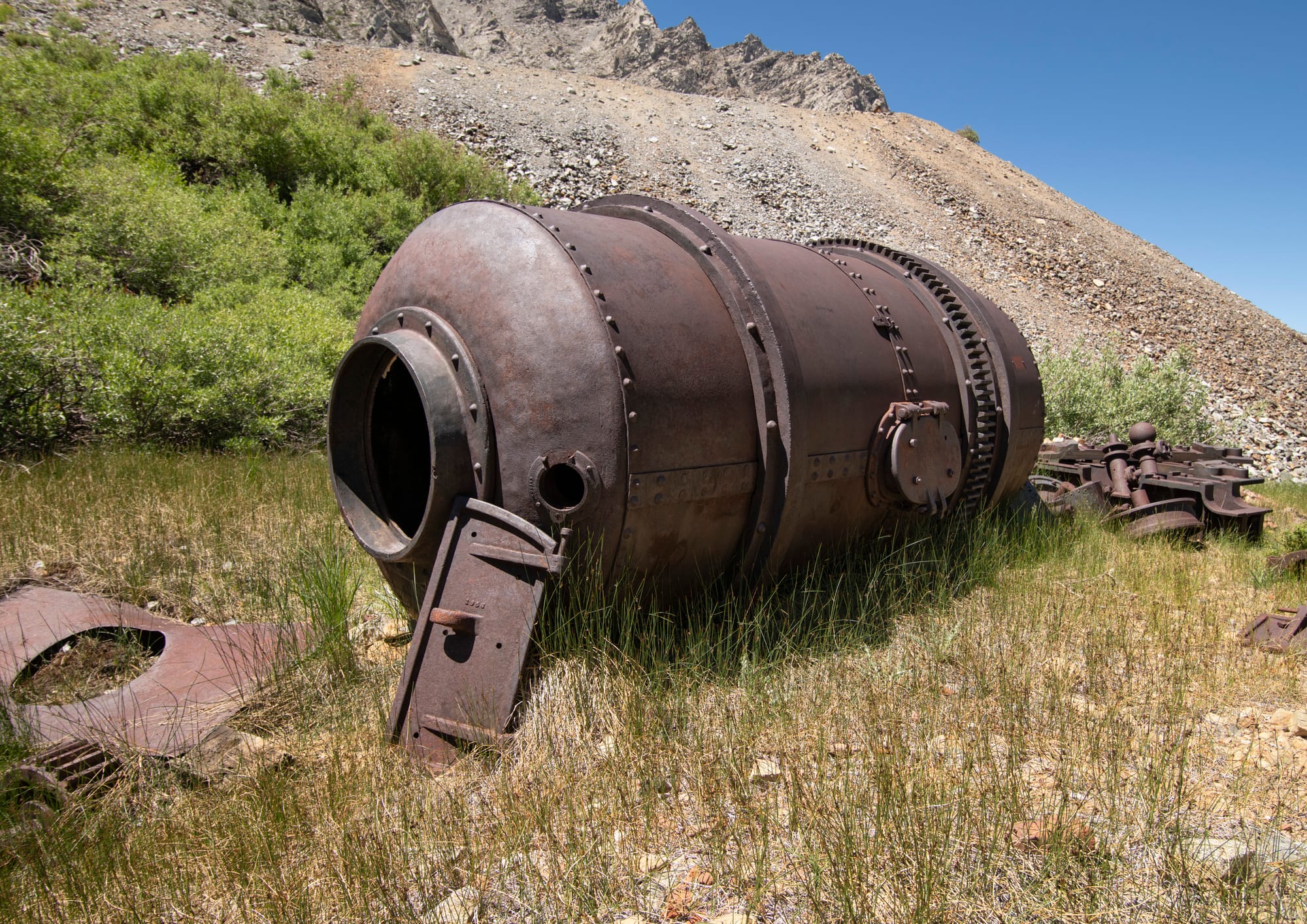
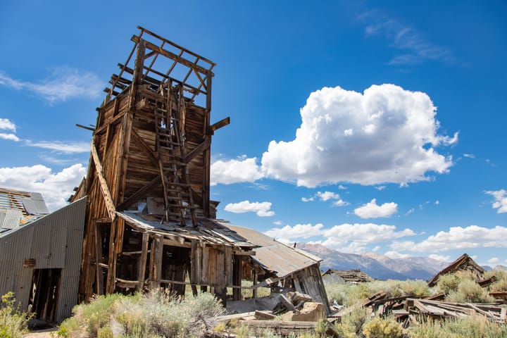
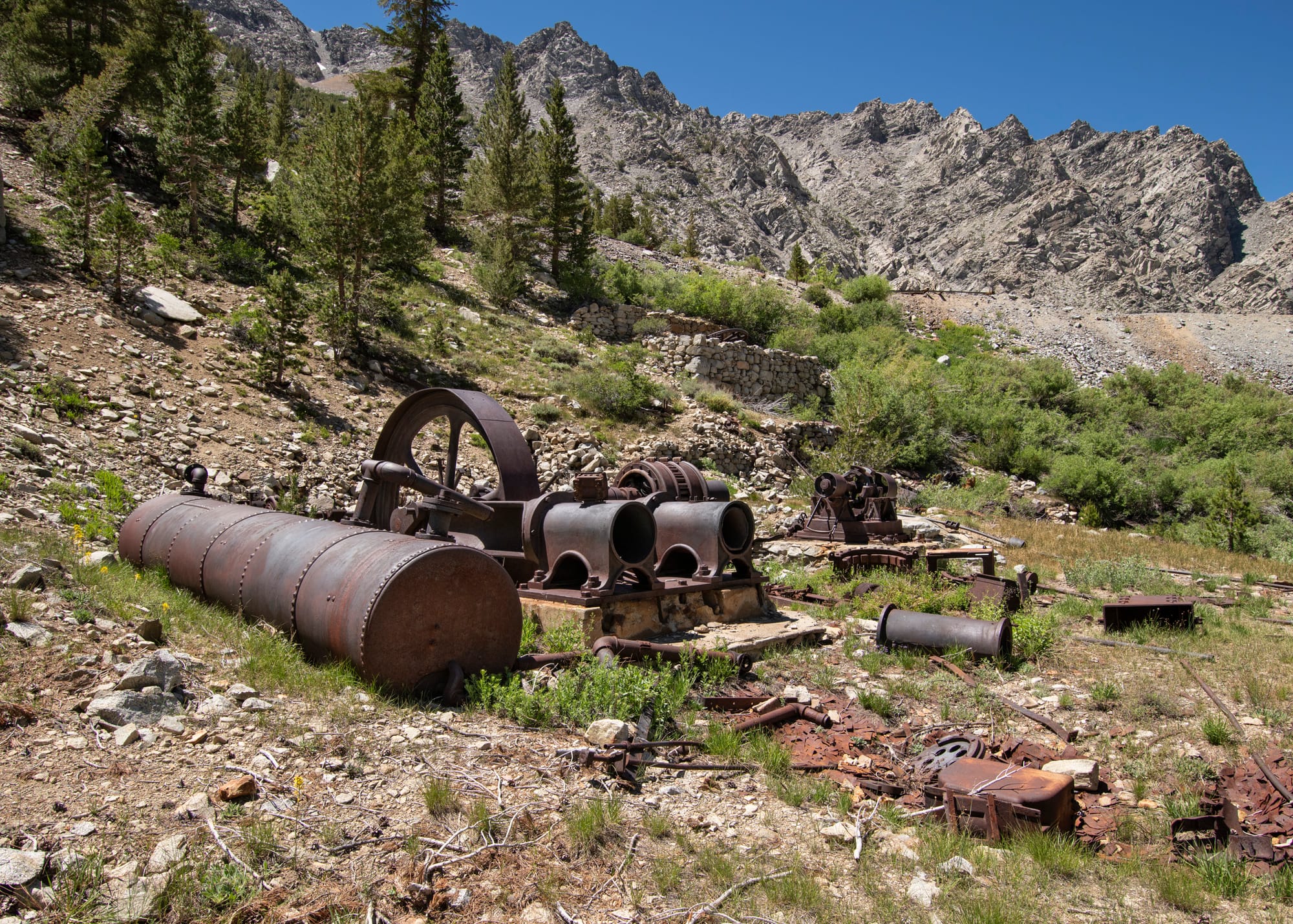
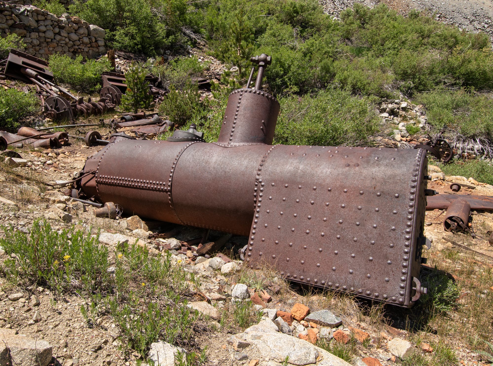
Finally, the May Lundy Mine went through one last effort to extract gold from the mountain. In 1921 Thomas Hanna (John Muir's son-in-law) bought the property, then in 1934 built a 40-ton flotation mill near the shore of Crystal Lake. The tailings from the earlier mill had been dumped in the meadow above Crystal Lake, and even into the lake itself. Hanna's more modern and efficient mill was capable of recovering gold still contained in the tailings. He also built a two-story bunkhouse and cookhouse near his mill, and rebuilt the powerhouse in Lundy to provide power. The operation was short-lived, however, as the operation was unable to cover its costs. The beginning of World War II led to all "non-essential" mining operations being forced to close, which precluded any further attempts to reopen the mine until after the war. By then, the remote location, neglected equipment, and low price of gold meant that the May Lundy Mine would not be feasible to reopen. The mine and mill site now lie within the Hoover Wilderness Area, permanently protected from further mining. Fire destroyed the 20-stamp May Lundy Mill in the late 1950s, and the main adit was sealed in the early 2000s. However, much of the mill equipment remains today, resembling an outdoor museum of turn-of-the-century mining technology.
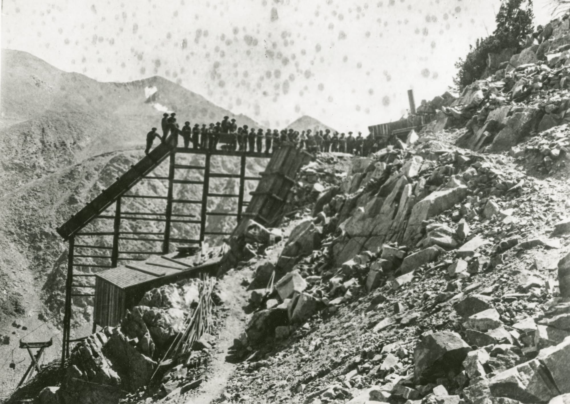
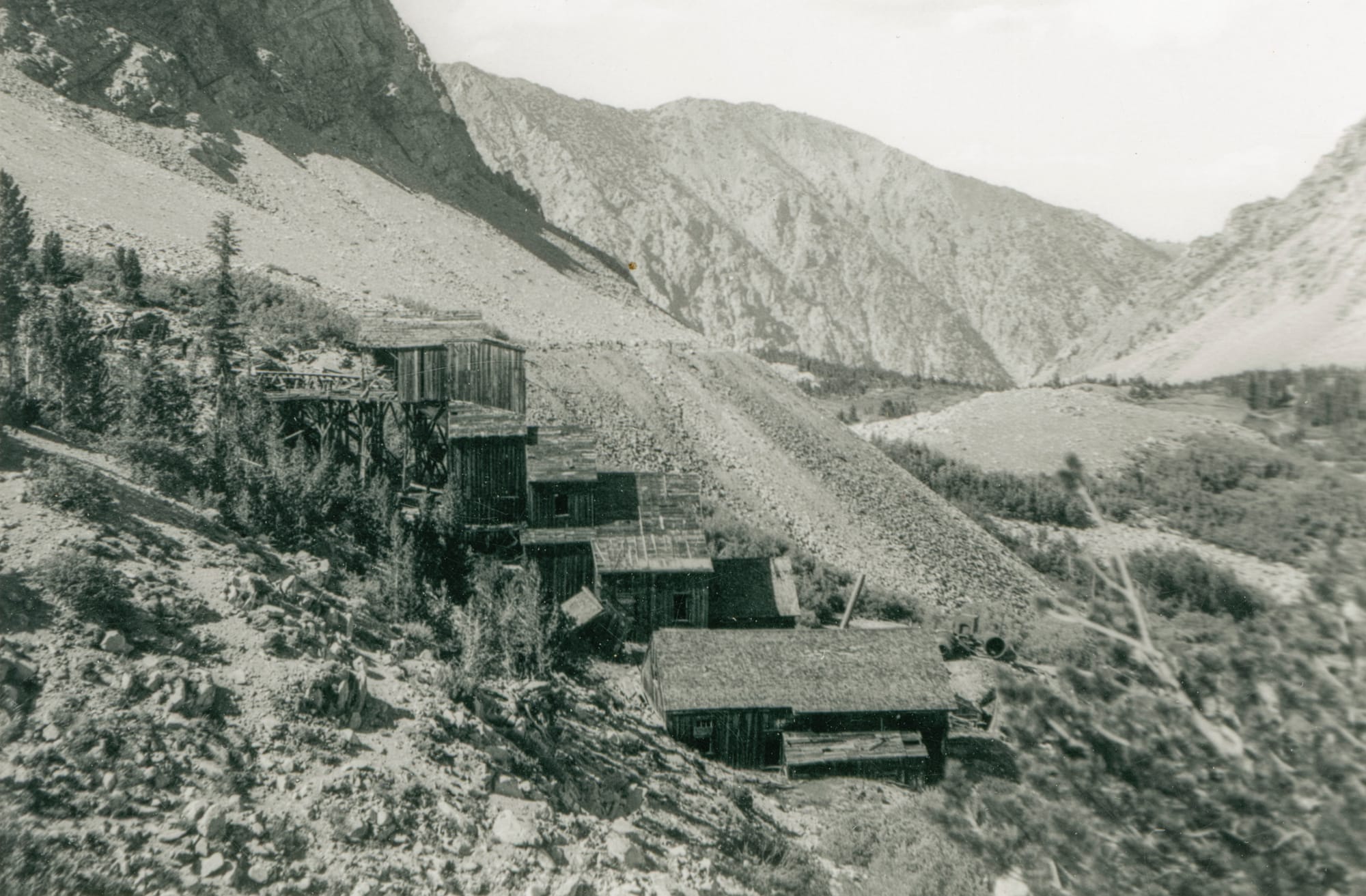
L: Upper workings of the mine, R: May Lundy Mill. Photos courtesy of Eastern California Museum, used with permission.
Hike Notes
There is much to see in upper Lake Canyon — too much for a single day hike. Although this trip covers only the May Lundy Mine, there are several other smaller mines in the area, well worth visiting in their own right. The Big Emma Mine, the Summit Mine, and the Tip Top Mine come to mind. (Note that all three of these are challenging hikes, recommended for experienced hikers only.) A visit to the May Lundy Mine can be done in a half-day, but you should give it a full day to savor the beauty of Lake Canyon as well as have enough time to fully explore the area. The listed Distance/Time figures only reflect hiking directly from the trailhead to the May Lundy mill site; further exploration can significantly increase both, and nothing comes easy up here (high elevations, very steep and rugged terrain). Multiple day hikes or a backpack trip are needed to experience all this spectacular canyon has to offer. There is a beautiful campsite at the southeast corner of Blue Lake, and a second very nice site near the dam at Lake Oneida.
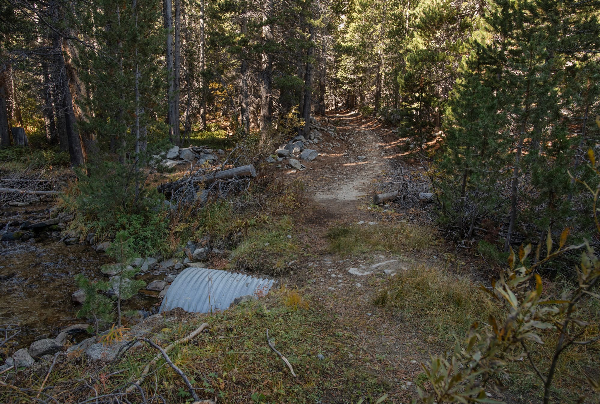
The hike to the May Lundy Mine follows the old mine road, making for a generally good trail. Some portions can get quite wet early in the year, where springs flood the trail or the trail crosses meadows; wear good boots. Drinking water is plentiful, although you should treat all water and avoid Crystal Lake (due to heavy metals from mine tailings). If you climb any canyon walls to the upper mines, expect very steep and rugged terrain, with route-finding and rock scrambling required. (You can also expect stunning views; this is not for the faint-hearted.)
The best time to visit is from early June to early October; this will vary according to the amount of remaining snow and any early snowstorms. The canyon features beautiful wildflowers in early summer and pockets of gorgeous fall color in early October. This entire area is very conducive to thunderstorms with lightning. Much of the hike is exposed if lightning occurs; you should avoid hiking here if thunderstorms are forecast.
A final note: historical artifacts abound in this entire area. Every time I hike here, I stumble across something I have not seen before. Take the time to explore, and keep your eyes open. Much of the canyon floor is heavily overgrown with brush and trees, which were often cleared during the mining days. As a result, cabins, old mills, and artifacts can be hidden anywhere, invisible until you are right on top of them. Please leave anything you find for the next visitor to experience.
Directions
Getting There
From downtown Lee Vining, drive north on Hwy 395 approximately 7.0 miles to the Lundy Lake Road/Hwy 167 intersection. (From downtown Bridgeport, drive south on Hwy 395 approximately 18.5 miles.) Turn west onto Lundy Lake Road, then proceed 3.5 miles to Lundy Dam Road, on the left. This short graded dirt road is 200 feet past the third and last entrance to Lundy Campground. (If you reach the lake, you missed it.) The parking lot for Lundy Dam is just 0.2 miles ahead; the trailhead is behind a large gate on the uphill side of the lot.
The Hike
Hike: Moderately Strenuous, 6.4 miles out and back, 1,835 ft gain round trip. 4-5 hours
The trail begins next to the large sign board behind the gate, then climbs the north slope of Gilcrest Peak above Lundy Lake. You will be following the old mine road to the May Lundy Mine. Just past the upper end of Lundy Lake, expect to encounter several stretches of spring water flowing down the trail. As you turn the corner into Lake Canyon, the trail climbs through a large marshy area; the trail can be very wet in this area.
As you exit the overgrown marsh, you will encounter the first of several very steep and rocky pitches. As you continue climbing, keep an eye out for several old power poles along the road, part of Thomas Hanna's 1934 mining operation at the May Lundy Mine. At 2.0 miles, you will reach a culvert where the road crosses Mill Creek; this is a good spot to get more water.
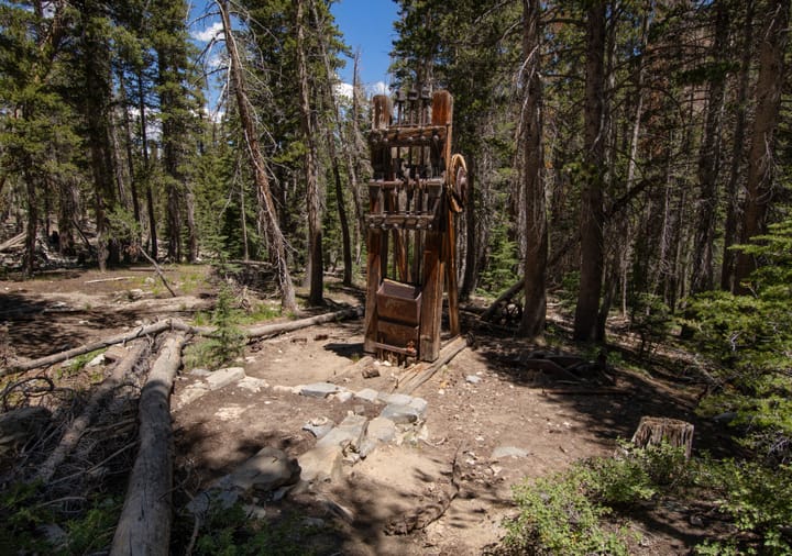
In another 0.4 miles, you will pass an old power pole to the left of the road. About 1,000 feet farther, look for some old metal parts on the left side of the road (38.00596°, -119.24619°, elevation 9,430 feet). These parts are from a Gilpin County Stamp Mill used at a small mill run by lessees of the May Lundy Mine in 1887-88. The ruins of the mill are about 200 feet east-southeast. Head straight into the woods; the mill is near the bank of the outlet creek from Blue Lake. The Pierce Mill, a small 1890s-era custom mill, lies hidden in the woods 160 feet south of here, also along the banks of the creek.
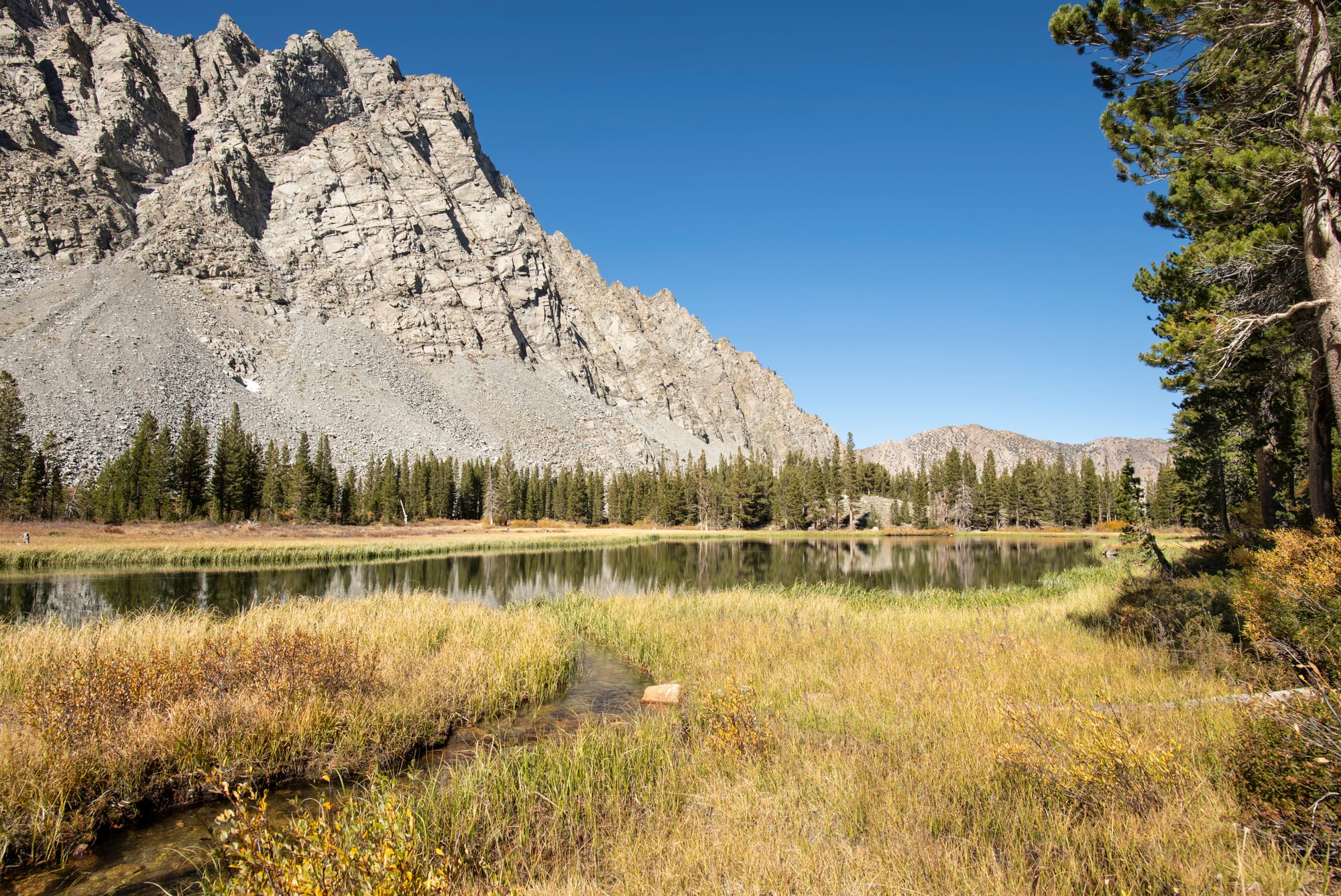
The long climb to the floor of Lake Canyon soon ends, at a large metal barrel sitting next to the road. The canyon opens up into a beautiful meadow, with gorgeous Blue Lake on the east side. A very old cabin foundation and beautiful campsite lie at the southeast corner of Blue Lake. Although it is possible to reach the east shore of the lake from here, it can be difficult early in the summer, as you would have to cross two outlet creeks from the lake or negotiate the marshy meadow. A better approach is to continue along the trail until past the meadow/marsh, then double back from the south. You will still have to cross the outlet creek from Crystal Lake, but it is much easier.
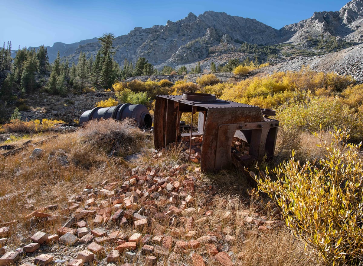
The trail continues through a brushy flat area, which can be muddy and wet all summer. Near the end of the meadow area, an old road forks southeast to the left, toward Crystal Lake. This short spur, about 500 feet long, will take you to the 1908 Crystal Lake Mill site. It is well worth the side trip to see; return to the main road when you are done.
Back at the road fork, you will now begin the final climb to the May Lundy Mine. The massive mine dump from the early-1900s adit soon dominates the view ahead; the mill site lies just beyond the adit.
Once you reach the adit (now caved in), you have several exploration options:
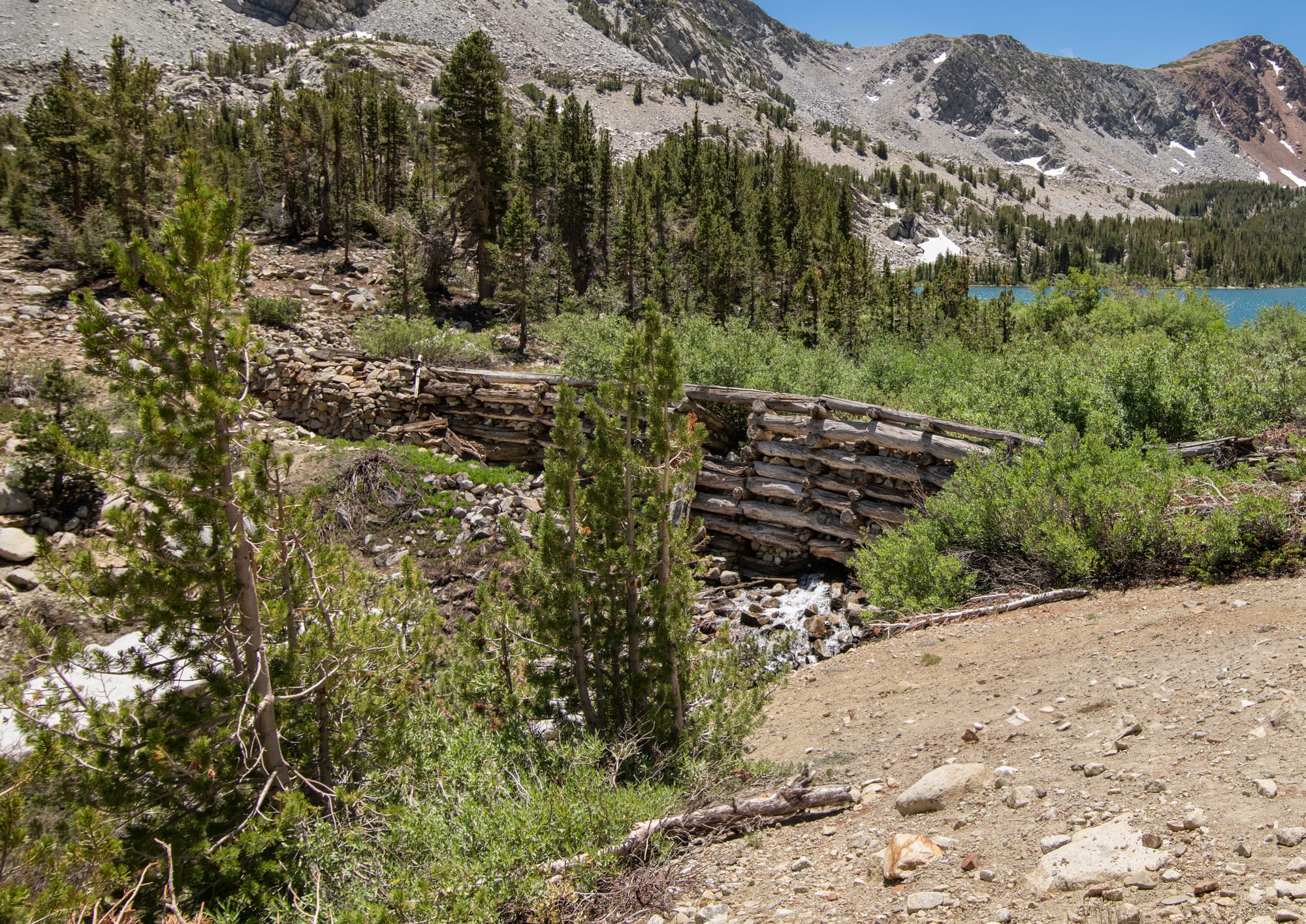
First: you can continue along an old road/trail to the dam at Oneida Lake (highly recommended). You will see many artifacts in the woods along this short excursion. Oneida Lake is the largest and most beautiful lake in the canyon. There is a nice campsite near the dam, if you are backpacking. Look for an old stone cabin just northwest of the dam.
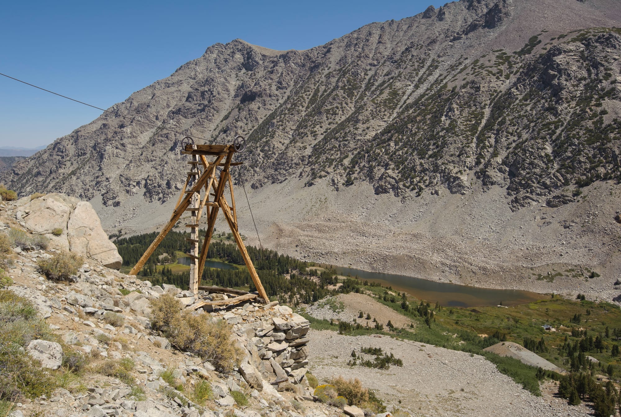
Second: you can hike up to the tram towers and bunkhouse at the upper mine — a challenging but rewarding climb. The lower part of the trail is difficult to find. The best approach is to start up the boulder/talus slope just south of the adit, aiming for the visible tram towers above. You will soon intercept a decent trail, which will lead to the tram towers, the ruins of the bunkhouse, and even the mines (all caved in).
Third: this part is mandatory... just south of the adit, near the end of the rails, follow a steep trail down the slope to visit the ruins of the 1891 May Lundy Mill. (Take a minute to get your bearings before you start down, in case you elect to bushwhack over to the 1934 Hanna Mill near Crystal Lake.) The ruins are extensive, and some of the equipment will boggle the mind.
Not much remains at the Hanna Mill, but if you want to see it, this is the best place to start your bushwhack over there (there is no trail). The mill ruins are about 600 feet east of the air tank/compressor/motors, near the southwest shore of Crystal Lake. Look for the remains of the Hanna bunkhouse/cookhouse about half way there. The best way to head back is the way you came — any attempts to take a shortcut back to the road will likely lead to impenetrable brush.
If you do this hike in the fall, remember that the sun sets early in this north-south canyon. The good news is that your hike back is downhill all the way!
Special thanks to Heather Todd (Curator) and the Eastern California Museum in Independence CA for research help and historical photos. Historical photos used with permission. Please visit this wonderful museum, and consider donating.
Map
GPS Waypoints
- Trailhead: 38.03123°, -119.21953°
- Culvert: 38.01324°, -119.24372°
- Mill trail: 38.00596°, -119.24619°
- Old mill: 38.00573°, -119.24556°
- Pierce Mill: 38.00536°, -119.24588°
- Road fork: 38.00184°, -119.24773°
- Crystal Lake Mill: 38.00052°, -119.24735°
- May Lundy Mine tunnel: 37.99914°, -119.25002°
- Oneida Lake Dam: 37.99733°, -119.25025°
- May Lundy tram tower: 37.99975°, -119.2538°
- May Lundy bunkhouse ruin: 38.00191°, -119.25588°
- May Lundy Mine: 38.0014°, -119.25722°
- Jackson and Lakeview claims: 38.00024°, -119.25671°
- May Lundy Mill ruins: 37.99876°, -119.24932°
- Hanna Mill: 37.99923°, -119.24743°