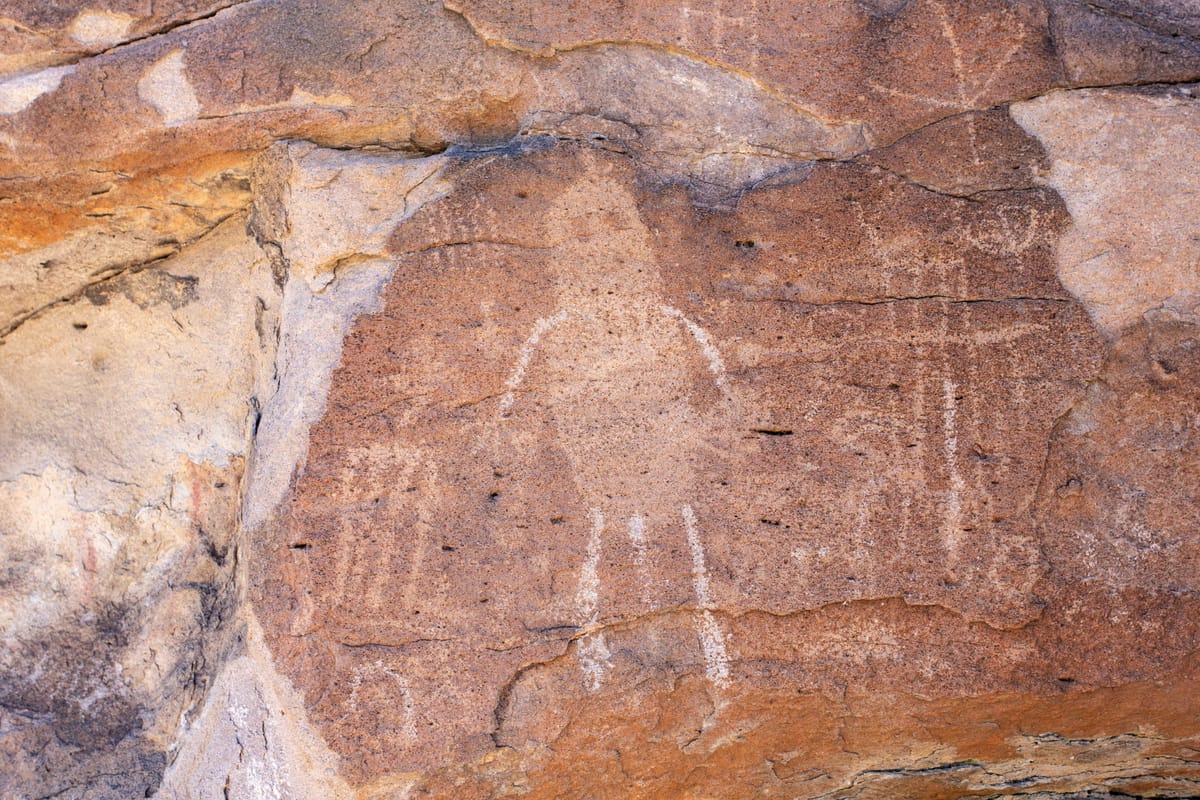
"Pahranagat Man" haunts this lonely valley. This distinctive anthropomorphic figure appears only in the Pahranagat Valley region, showing up at Mount Irish and a handful of other nearby sites but nowhere else in the American West. It's a fun challenge hunting him down among the volcanic rocks, and Mount Irish is one of the easiest places to find him. The site now lies within the Basin and Range National Monument.
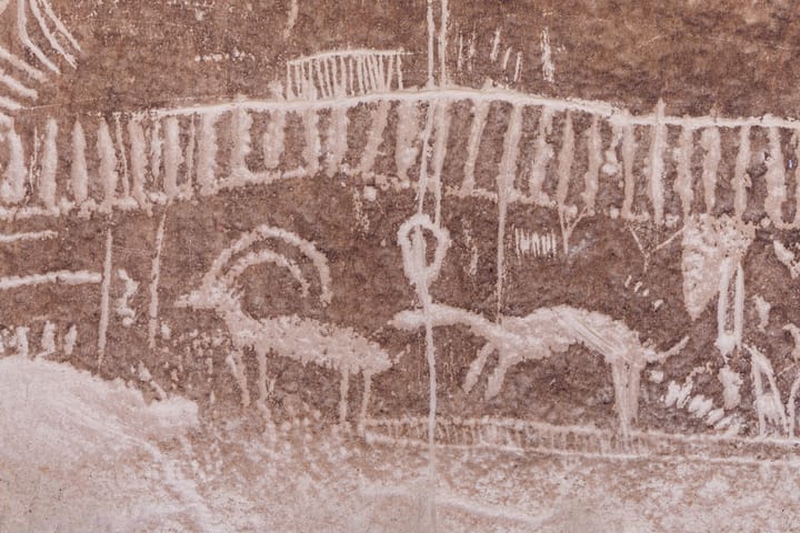
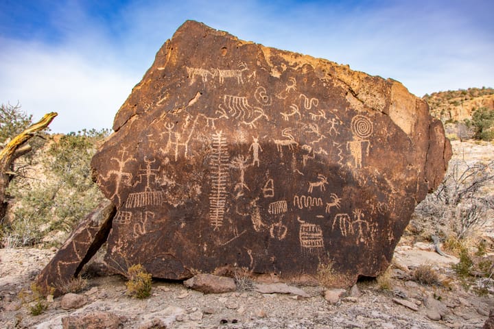
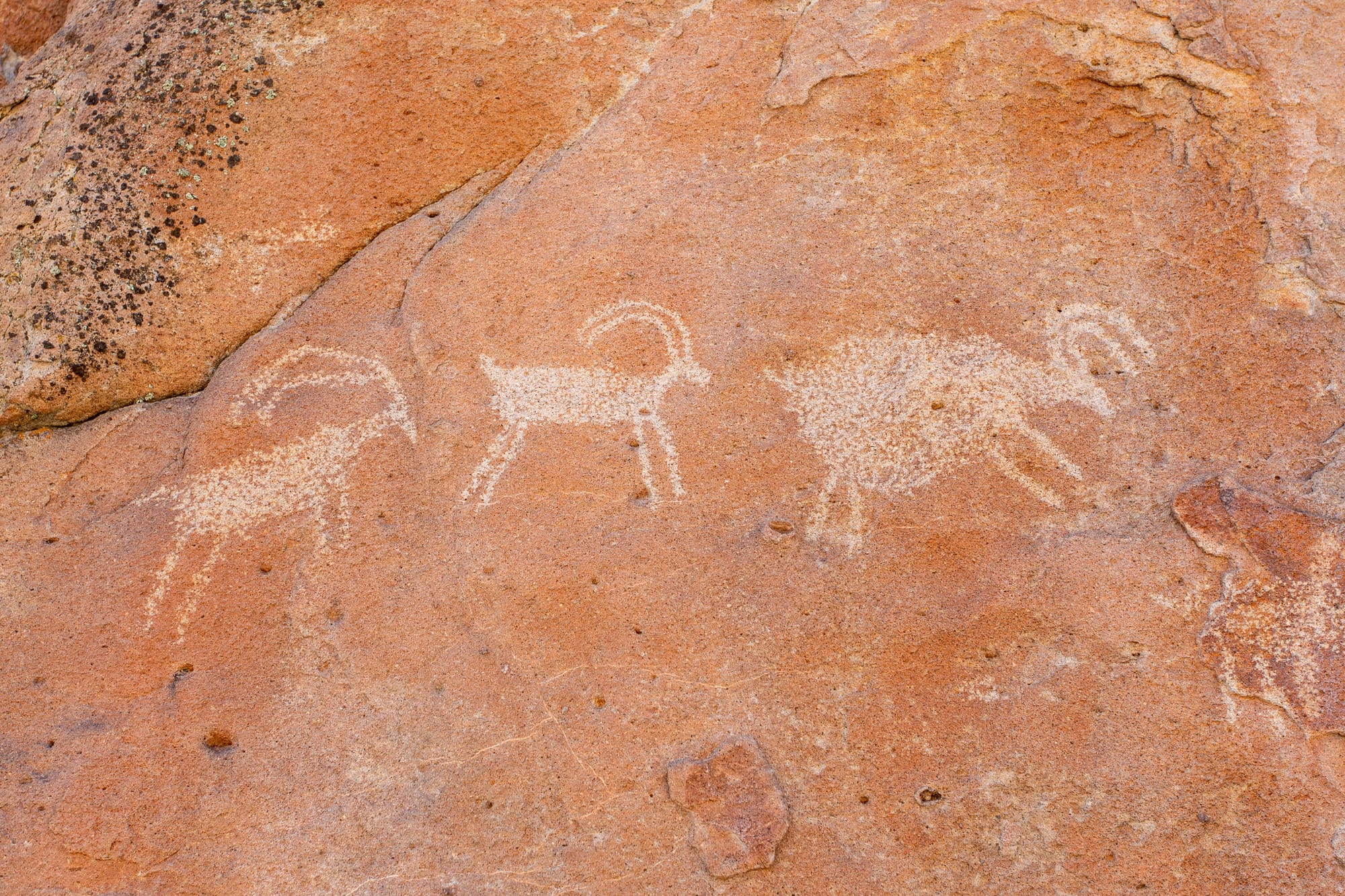
Here at Mount Irish, these unique human figures share the volcanic rocks with abundant bighorn sheep imagery. Some panels date back 4,000 years, making this one of the Great Basin's most significant rock art sites. Shaman Hill alone contains 129 panels, making it one of the largest single sites in eastern Nevada.
The district includes numerous rock art areas, but the three main sites are Paiute Rocks (Locus IV) with its interpretive trail, and the nearby hills of Shaman Knob (Locus V) and Shaman Hill (Locus VI), which require a short walk from the main road. You'll also pass the wash petroglyphs (Locus I) and Echo Rock (Locus III) along the way.
Prehistory
Hunter-gatherer cultures used the Mount Irish area from the Middle Archaic period (roughly 6000 BC) through the Late Prehistoric era (ending around AD 1860). They established temporary camps drawn by seasonal bighorn sheep hunting and pine nut harvests. The area saw its most intensive use between 2,000 and 500 years ago. Rock shelters, stone tools, and tool fragments scattered around the petroglyph panels show that people processed animals and plants, made tools, and prepared food in the same places they created rock art.
The petroglyphs were also made over a long period of time. Basin and Range style art, dating from roughly AD 1 to 1500, dominates the district with its finely made abstract designs, stick-figure humans, and abundant bighorn sheep imagery. Pahranagat style figures are found only in this valley and a few related sites (also see Shooting Gallery), often include "attendant" figures suggesting spiritual or supernatural significance.
Different patination levels, which is the natural darkening of rock surfaces, reveal that new images were added to existing panels over time. The most recent Native American use of the area continued into the 1860s, documented through pottery fragments and historical records of Paiute and Shoshone presence.
Thousands of years of wind and water haven't destroyed these petroglyphs, but a few thoughtless visitors could. Please don't touch the rock art.
Directions
Getting There
Road: 9 miles, graded dirt
From the junction of State Routes 375 and 318, just south of Hiko, drive north on SR 318 for 2.5 miles. Turn left (west) onto the old Logan City road, marked by a wire gate just past the Key Pittman Wildlife Management Area. Pass through the gate and head northwest. Close the gate after you go through it.
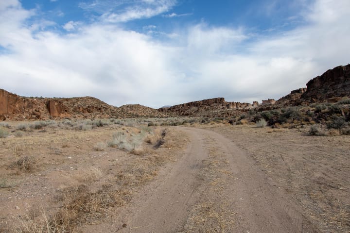
The main access road requires a vehicle with good ground clearance but remains passable to most cars in dry conditions. The road winds through sagebrush country, crossing alluvial fans that spread from mountain bases. Volcanic tuff outcrops dot the landscape, providing the canvas for ancient artists.
Wash Petroglyphs
At 6.45 miles from the gate, a side road branches left into a wash. Park here and walk 2,000 feet up the wash to reach the wash petroglyphs (Locus I).
Echo Rock Petroglyphs
At 6.85 miles, park on the main road and walk a short distance south to Echo Rock (Locus III), where a shout toward the rock face produces a clear echo. Continue past a campground at 8.15 miles.
Paiute Rocks
At 8.6 miles, pull into the parking area for Paiute Rocks (Locus IV). An interpretive trail with numbered markers guides you counterclockwise around a complex of boulders covered in petroglyphs.
Shaman Hill and Shaman Knob
At 8.8 miles, turn left onto the 4WD spur road. The initial section climbs steeply over loose rocks. Vehicles without high clearance and 4WD should park at the turnoff and walk the final 0.15 miles to reach the trailhead for Shaman Knob (Locus V) and Shaman Hill (Locus VI). The numbered signs can be hard to find, and you'll need to hunt to find all the panels. The trail goes around Shaman Knob, while it splits at Shaman Hill.
Map
KML
GPS Waypoints
These are groups of petroglyphs. You will have to scout around to find them all.
- Entrance Gate: 37.56654°, -115.23139°
- Wash Petroglyphs: 37.6018°, -115.3389°
- Echo Rock Petroglyphs: 37.60491°, -115.34429°
- Mt Irish Campground: 37.60304°, -115.36643°
- Paiute Rocks Petroglyphs: 37.6062°, -115.37326°
- Shaman Hill Petroglyphs Trailhead: 37.60657°, -115.37845°
- Shaman Knob Petroglyphs: 37.60664°, -115.37761°
- Shaman Hill Petroglyphs: 37.60651°, -115.37903°
Photos are from 2003, 2010, and 2025.