Tungstar Mine Tram

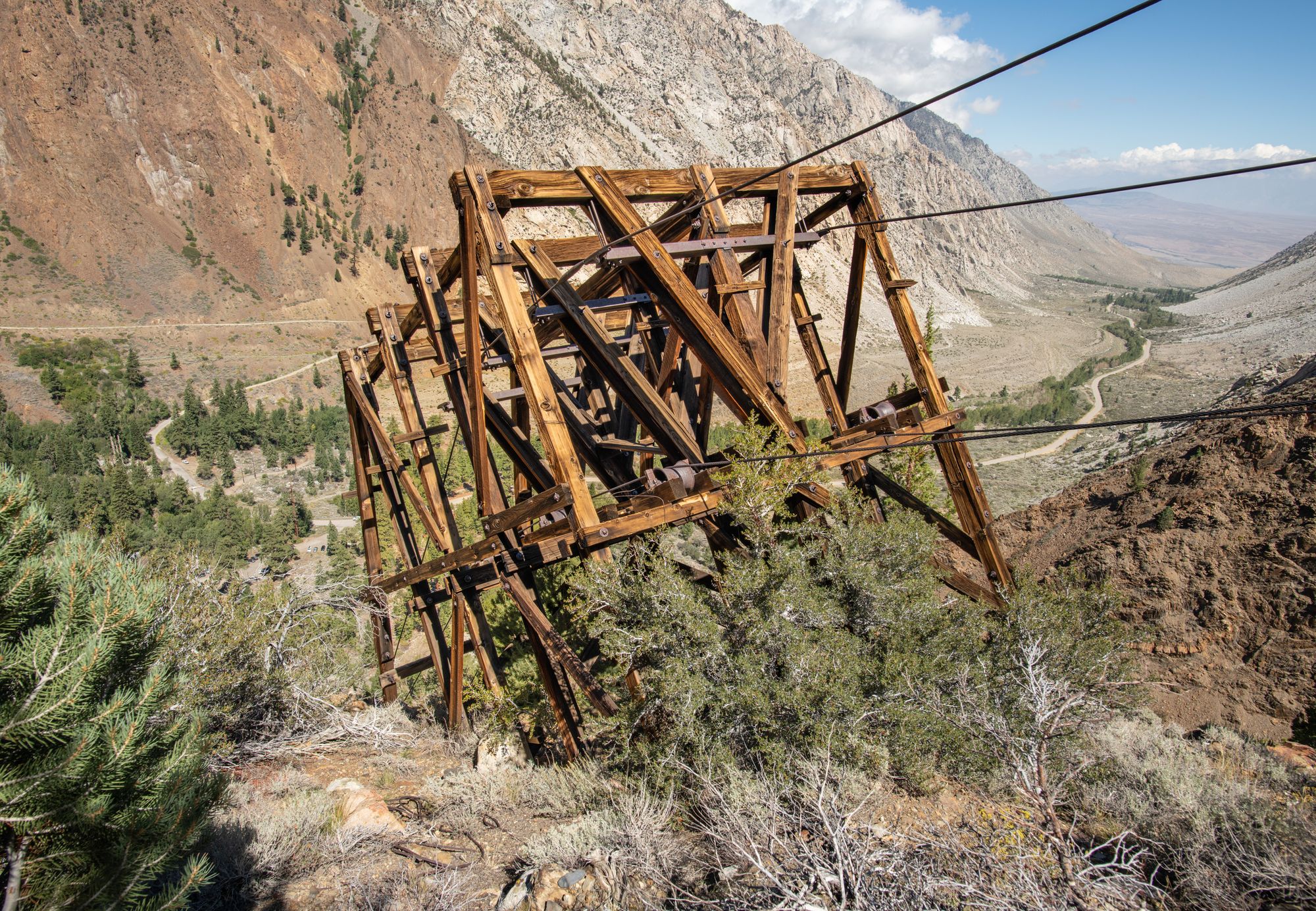
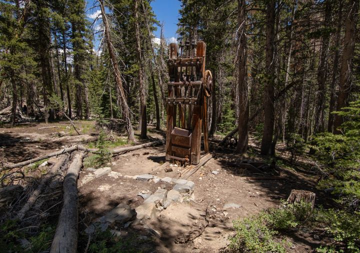
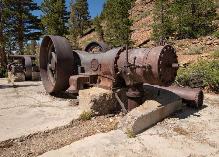
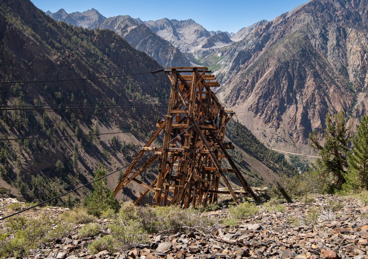
This very adventurous hike follows an old mining trail which led to the Tungstar Mine, a 1940s tungsten mine high on the western slope of Mt. Tom, the prominent 13,658-foot peak just west of Bishop. The trail was used in the early days of the mine to build a tram between the mine and the Tungstar Mill, situated on the floor of Pine Creek Canyon next to today's Pine Creek Pack Station. The trail, now designated the "Gable Lakes Trail" in the Inyo National Forest, forks about one mile from the trailhead. The maintained Gable Lakes Trail continues on to Gable Lakes and the Lakeview Mine. Several of the lower tram towers can be easily seen close to the trail along the first mile.

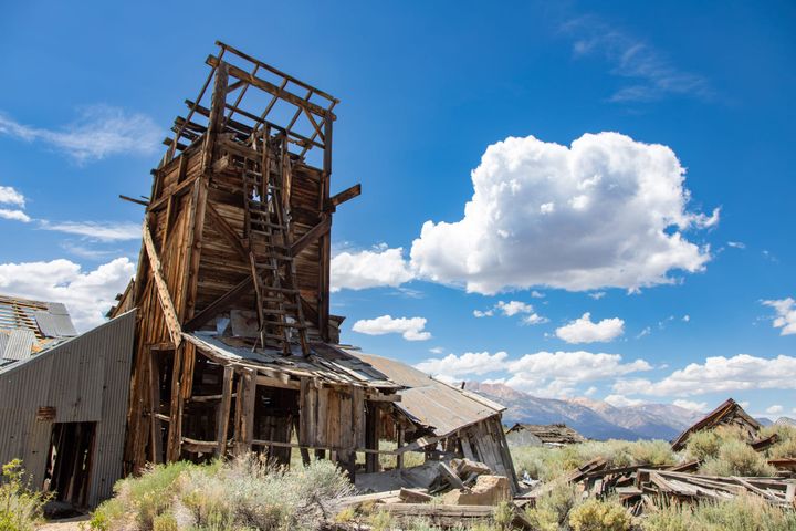
At the fork, the unmaintained mine/tram trail crosses Gable Creek, then winds its way up to the Tungstar Mine at 12,000 feet. Hiking this part of the trail involves a difficult creek crossing, as well as navigating very steep and rugged terrain along a spotty trail that has seen little use since the 1940s.

First tower above the Tungstar mill

History

Several scheelite deposits (a tungsten ore) were discovered in the Pine Creek area in the 1930s. With the advent of WWII, the remote deposits at higher elevations became economically feasible to mine. The nearby Pine Creek Mine, behind the locked gate next to the pack station, would become the leading tungsten producer in California, with the Tungstar Mine in second place. Several movie stars, including Randolf Scott and Shirley Temple (through her father), invested in the Tungstar claim, hence the name of the mine (tungsten and movie star). Because the extent of the ore deposit was not yet known, the investors initially authorized only a limited budget. A small mill was built near the junction of Gable and Pine Creeks, and the R. N. Riblet Tramway Company was contracted to design and build a tram from the mine to the mill.

Within a year, it became apparent that a larger mill and a better tram would be needed. The original tram towers were too small for the tram buckets to clear large snowdrifts in the winter, and the tram was plagued by frequent breakdowns. The Western-Knapp Engineering Company of San Francisco was then contracted to build a new, larger mill in 1940, and subsequently a larger and more reliable tram.

The original tram design actually featured two trams. A smaller jigback tram ran from the mine at an elevation of 12,000 feet down to a transfer station at 10,600 feet. The ore was then transferred to a larger A. Leschen & Sons double-rope tram, which ran the remaining 10,500 feet (slope distance) down to the mill at 7400 feet. Most of the Leschen tram towers were metal. Twenty-two ore buckets rode on 1 1/4" wire rope (loaded) and 1" wire rope (unloaded), pulled by a 3/4" traction rope.

The new tram, finished in 1942, was a continuous double-rope tram with an inclined length of 11,800 feet. There were sixteen towers, with a cable-tension station near the midpoint, at an elevation of 9600 feet. The longest span was an amazing 2400 feet, where the cables crossed 500 feet above Gable Creek.

An electric motor was required to start the tram, after which the loaded buckets provided enough energy to drive the tram, as well as power a generator up at the mine. Most of the original tram was disassembled after the new one was built; only a few towers and the ruins of the jigback transfer facility remain. Most of the newer tram's towers still remain today, although several are in various states of collapse.

The tram operated until 1945, when the good ore ran out and the mine was closed. The mill operated for a few more years, processing ore from the Tungsten Hills. A 1952 avalanche wiped out the mill buildings; very little of the mill remains today, beyond the concrete foundations.

Fortunately, one major piece of equipment from the mill area has survived. The tram's drive machinery, which was located at the bottom of the tram, can be seen at the Laws Railroad Museum just north of Bishop. This outstanding museum, which features much more than just railroad displays, is well worth a visit.

Gable Creek

The Hike

This hike description covers only the lower half of the tram, up to the "Tension Station Tower" at 9600 feet. The trail once continued all the way up to the Tungstar Mine, but several segments of trail higher on the mountain are now missing. Although the mine itself is well worth a visit, this trail is not a practical route— it would be a seven-mile hike (one way), with a climb of 4400 feet, over very difficult terrain. A much better route, although still difficult, is hiking in via the Horton Lakes trail, on the south side of Mt. Tom. For a description of that hike, along with photos of the mine, see Hanging Valley and Tungstar Mines.

Although many of the tram towers can be seen close to the trail in the first mile of this hike, two of the best towers lie on the east side of Gable Creek. The large "A-Frame Tower" at 9400 feet, and especially the "Tension Station Tower" at 9600 feet, are two of the most spectacular tram towers found anywhere. However, getting there is problematic.

I would rate the first mile of the hike "moderate", mainly due to steep grades; any fit hiker should have no problem. After that, crossing Gable Creek and following the spotty trail on the east side, over very steep and rugged terrain, is strenuous and recommended only for experienced hikers. This hike should not be taken lightly. The biggest challenge is crossing Gable Creek: it is a fast-moving cascade through a narrow and steep gorge. It should only be attempted when the water is low, and is difficult even then. I crossed it in September 2022, a record drought year, and fell into the creek trying to cross on top of a log. (Those logs are slick when dry; when wet, they are impossible.) There is no place where you can "rock hop" across; I recommend taking water shoes and wading at the safest spot you can find, with trekking poles. The creek is lined with clusters of Stinging Nettle, which you will definitely want to avoid. A real GPS (not a smartphone!), a headlamp, and long pants (gaiters recommended) are all essential. (There are a few brushy sections, where you will be wading in brush up to your waist.) A water filter is also a good idea— you can get water at Gable Creek going both directions (avoid the Stinging Nettle!) The trail down into the gorge, as well as the trail up the east bank of the creek, ranges from sketchy to non-existent; plan on getting back out of the gorge and onto the main Gable Lakes Trail before dark. Be conservative with your time estimates; this hike will likely take longer than expected.

If all that sounds like too much for you, or the creek is too high to safely cross, there is a good alternative. Most of the towers can easily be seen in an enjoyable half-day hike of 1.2 miles (one way), with an elevation gain of 1200 feet. The last tower on the west side of Gable Creek, at 8400 feet, is just under a mile from the trailhead. Only 1/3 mile further, and 250 feet higher, is a large flat area next to the trail, which is a perfect resting/lunch/viewing area. Almost all of the higher towers, all the way up to the mine, can be seen with binoculars from this general area.


Directions