Hidden in the mountains just northwest of Mono Lake lie two of the most beautiful canyons in the Eastern Sierra, Lundy and Lake Canyons. Perched high on the wall of Lake Canyon, in a seemingly unreachable location, sits the remains of the Big Emma gold mine. This adventurous all-day hike will lead you up an old mining road into spectacular Lake Canyon, then through the woods to a spotty mine trail which climbs up to the mine. Along the way you can visit two century-old gold mills as well as the ruins of a stone cabin. Adventurous hikers can continue 500 feet past the Big Emma Mine to the Little Emma Mine, although serious caution is advised.
History
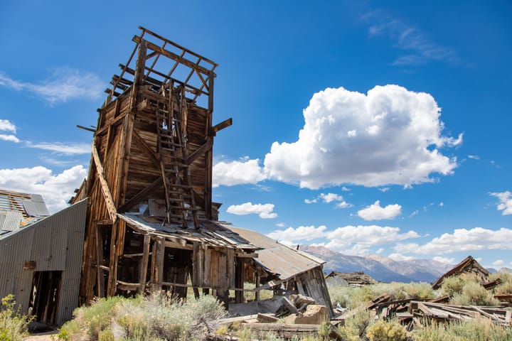
The Homer Mining District was founded in 1879, when gold was discovered in Lundy Canyon. By the turn of the century hundreds of claims had been filed. The most productive mine in the district was the May Lundy Mine in Lake Canyon, a hanging canyon which drains from the south into Lundy Canyon. The May Lundy was worked intermittently from 1880 until 1942, when it was closed as a non-essential mine, never to re-open. Several smaller mines, some in almost inaccessible locations high on the canyon walls, contributed to the district's output until the early 1900s.
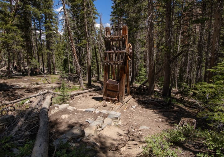
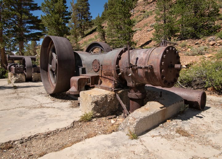
Two of the least accessible mines in Lake Canyon were the Big Emma and the Little Emma. Despite their similar names and close proximity, they were unrelated: the Little Emma was discovered in 1880, the Big Emma in 1894. Production records from that era are scarce, but it appears that both produced some of the richest ore in the district. Ore from the Little Emma was processed in an arrastra on the floor of Lake Canyon, while the Big Emma's ore was processed at the Pierce Mill, a small custom mill on the banks of the south fork of Mill Creek (see the map below).
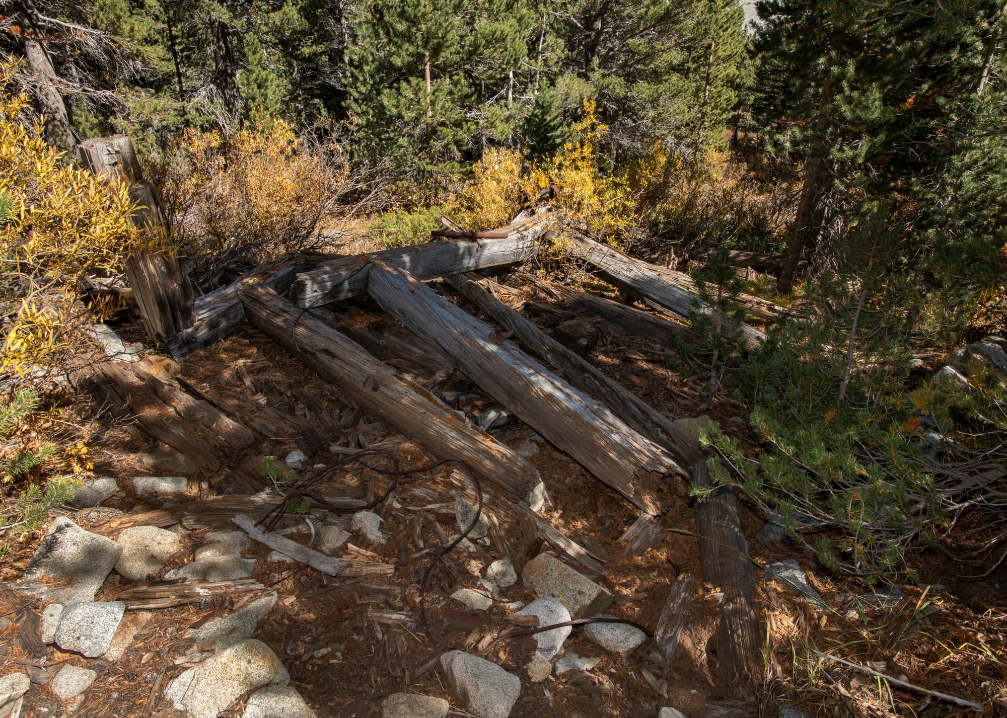
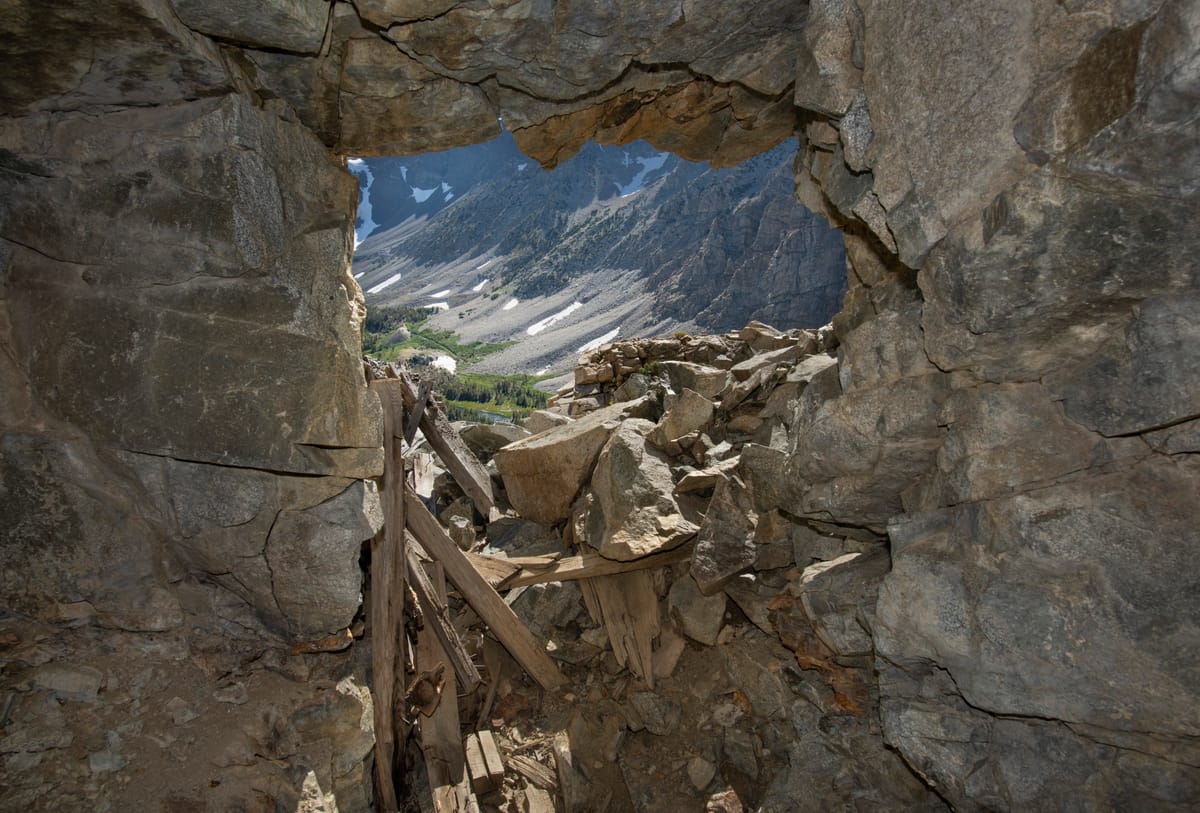
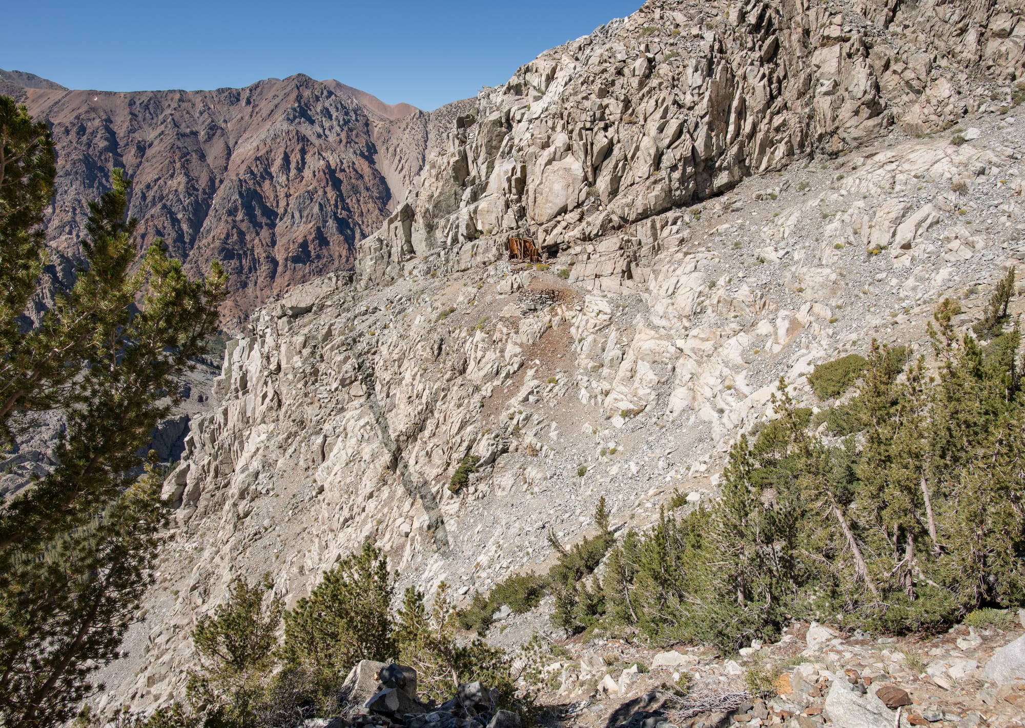
Today, what little remains at the Big Emma is succumbing to time and the elements. Two small piles of weathered wood indicate the location of a blacksmith shop and a doorway which once protected the portal. Inside, the single adit leads to a couple of short drifts and a winze with a windlass still in place.
A few other workings are scattered across the nearby slope, but they don't appear to be substantial, and are difficult to access. The Little Emma appears to be in slightly better shape, but I was unable to reach it on my two visits to verify this. Despite being called the "Little" Emma, it was actually more substantial than the "Big" Emma. A weathered cabin and shed, visible from the floor of Lake Canyon, still stand at the entrance of the mine.
Hike Notes
Although this hike is only 7 miles long (round trip), it is a difficult and strenuous hike. The first couple miles, along an old road, are not too bad, although there are some very steep pitches. The first difficulty lies in crossing the canyon floor, from the old road over to the base of Gilcrest Peak. The swampy marsh around Blue Lake must be crossed, or, alternatively, you can cross the south fork of Mill Creek twice (recommended). Next, after arriving at the base of Gilcrest Peak, you must work your way up a large boulder and talus slope until you reach the old mining trail. The trail is then difficult to follow, as it has not been regularly used or maintained in over a century. It is imperative that you follow the trail, as the route traverses very steep, rugged, and avalanche-prone terrain. If you lose the trail, take the time to re-acquire it; don't try to "wing it". Route-finding and rock scrambling skills will be required; don't expect to see a good trail, boot prints or rock cairns up here. This hike is for experienced hikers only. I highly recommend that you download my waypoints and route and use them as a guide.
The route from the Big Emma Mine to the Little Emma is over a small ridge, then across an avalanche chute. Any semblance of a trail across the chute is long gone. Even though it is "only" about 400 feet, it would likely take considerable time and effort, requiring scree-slogging and rock scrambling, maybe even climbing. Proceed at your own risk; I elected to turn around.
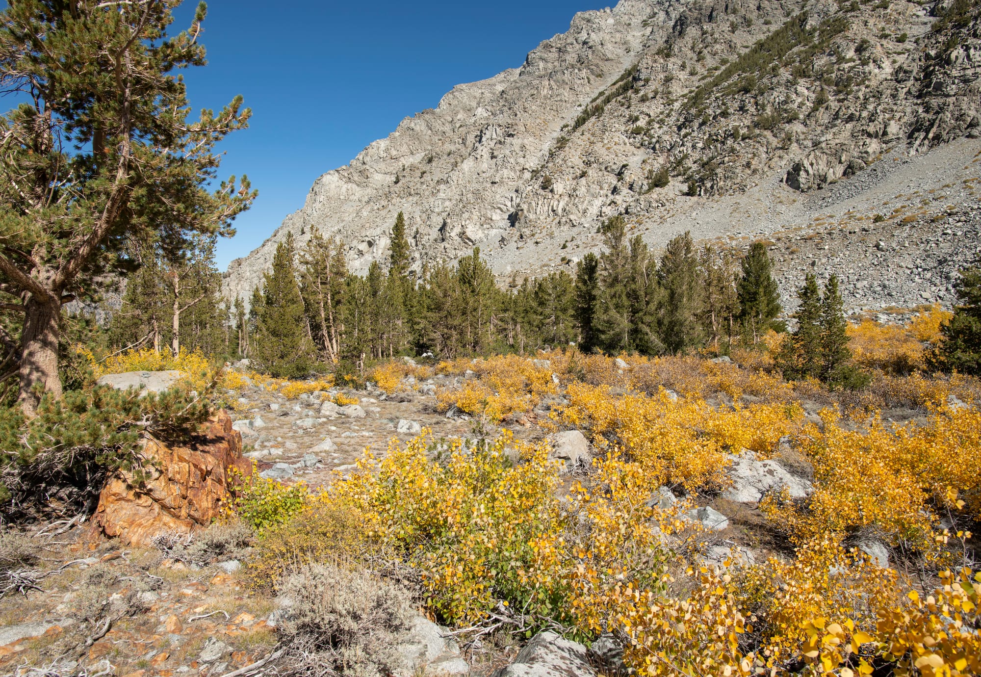
This hike should not be attempted until all the snow has melted off the west face of Gilcrest Peak. Parts of the trail can be very wet, from upper Lundy Lake to the base of Gilcrest Peak, early in the season in wet years. (Good waterproof boots recommended.) There is limited shade, except in the woods in Lake Canyon. This is an all-day hike, so plan on an early start (sunrise is not too early); the sun sets early in Lake Canyon. For these reasons, I recommend doing this hike in mid-June to mid-August. There are several opportunities to refill your water bottles until you cross the south fork of Mill Creek the last time; be sure to treat the water.