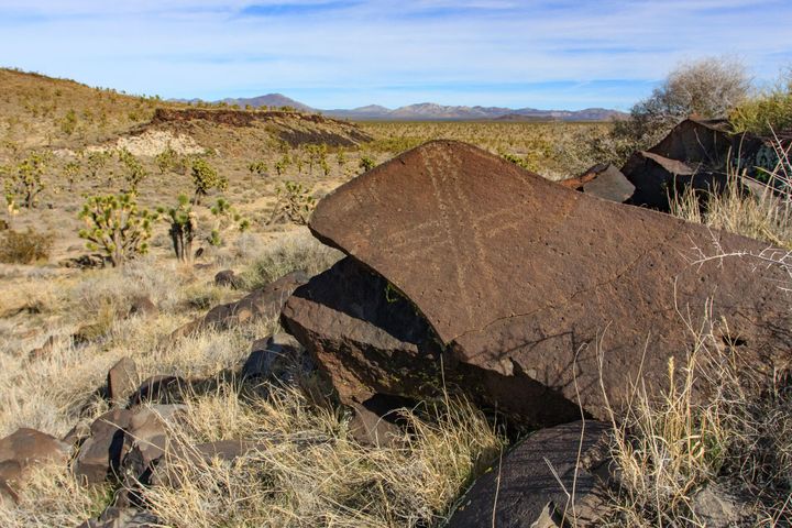
GPS Only
These trips have GPS waypoints (but not detailed directions). GPS waypoints are limited to paid subscribers. GPS coordinates are in Degrees unless otherwise stated. WGS84 Datum.
Be sure to scroll down to load all of the posts.
241 posts
Sylvania Mill
This mine was discovered in the early 1870s and was worked first by Mexicans. In 1909, the Clair family bought the claims and worked for a long time after.
Nevada Triumph Mine
Land of Zion Wash Petroglyphs
This petroglyph site is a small one in the Sonoran desert. It is a dry and harsh area. Scattered among the heavily varnished boulders are a few Desert Abstract petroglyphs. I also found what appeared to be rock circles. Maybe this was a small village? This site is also known
Gearwheel Arrastra
The old arrastra site and camp are a bit of a hike to reach, but it is well worth the effort. (An arrastra is a circular stone platform used to crush ore.) The camp appears to have been used mainly during the 1930s Great Depression, but the tin cans found
Cow Cove Petroglyphs
In 2008, Alysia and I went on a day trip to check out the petroglyphs at Cow Cove in the Mojave National Preserve. This is Chemehuevi and Mojave country and reminds me of Grapevine Canyon in Southern Nevada.
Sand Flat Pictographs
The Drztgrls, Alysia, Dan, Boxcar, and I went in search of a hidden shelter with some petroglyphs and pictographs. It is on the edge of a small basin that probably held a lake in wetter times. Getting out there is a bit of a hike, but it is worth the