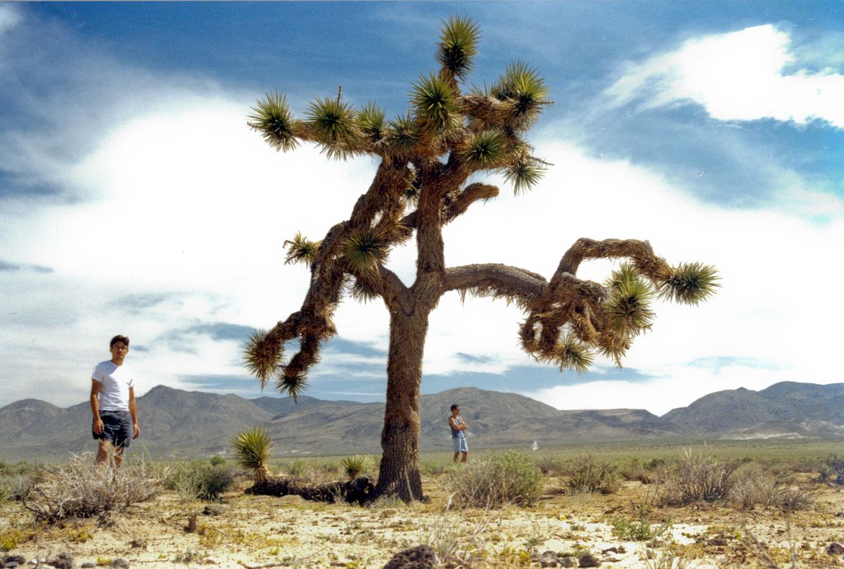
I found what I was looking for... The famous U2 Joshua Tree. It fell over many years ago and now is a shrine to the band and the album. It is surprisingly easy to reach and not in Joshua Tree National Park.
Directions
Getting There
To get to the U2 Joshua Tree Shrine, start from the intersection of highways US 395 and CA 136 just south of Lone Pine, California. Here at the corner is the Eastern Sierra Visitor Center. It is worth the visit if you haven’t been there before. Head east on Highway 136 for 25.9 miles and park on the side of the road.
On the way, you will drive past Owens Dry Lake and up onto the sagebrush-covered Darwin Plateau. You will pass an intersection where CA 190 joins in at 17.5 miles but continues straight up into the volcanic hills. You’ll probably be thinking, “I don’t see any Joshua trees out here.” And think I’m pulling your leg. I’m not. Joshua trees are few, but they are here.
Park off of the highway just past milepost 32 and beyond a slight curve in the road. Be sure to park all the way off of the pavement and on the dirt. There is no trail. It is a short quarter-mile walk south across the flat high desert plateau to the shrine at the fallen tree. It can’t be seen from the highway. Even without a GPS, you can find it. Bring a copy of the album cover and line up the hills in the background.
Map
KML
GPS Waypoints
- Pullout on highway: 36.3345°, -117.7447°
- U2 Joshua Tree: 36.3309°, -117.7453°